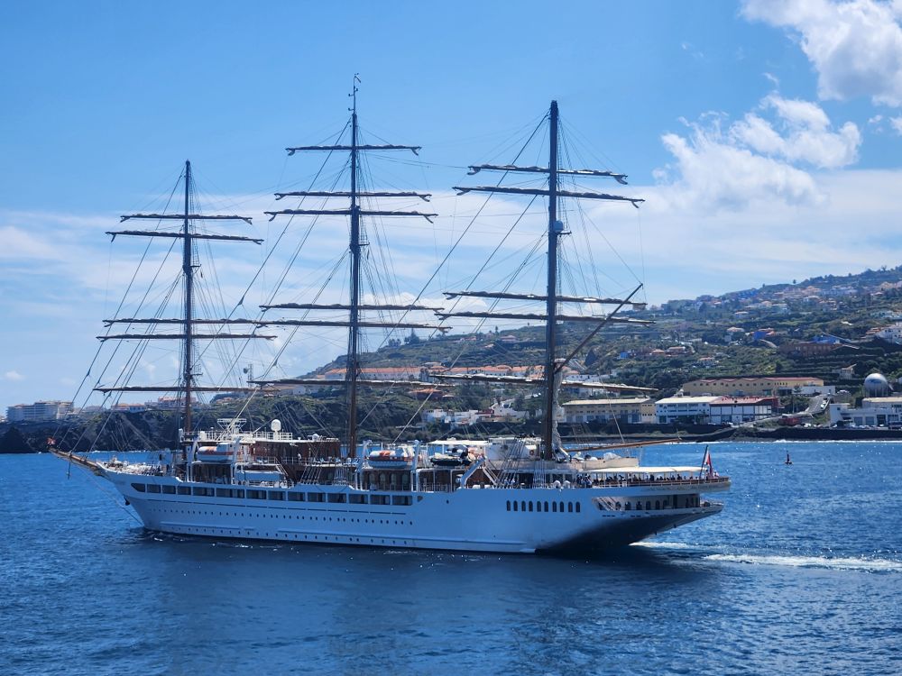
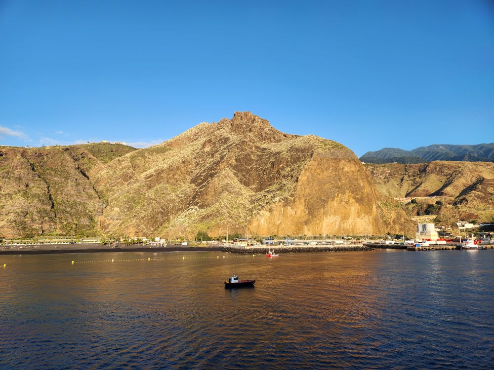
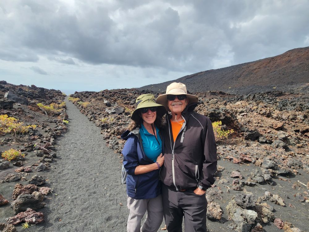
We sail in right on time, through a beautiful harbor lined with huge sandstone looking craggy hills. Today is our last ship tour – the San Antonio volcano hike, which we hope will go off well and people will have read the description carefully! We are first out, first on the bus, and joined by our Denmark friends from Mindelo as well as 16 others. Our guide today is named Evian, originally from Belgium, he settled here years ago and is so knowledgeable about the island and the Canaries, he might as well be local. Speaks Spanish like a local, just listening to his conversations with the driver, Felix.
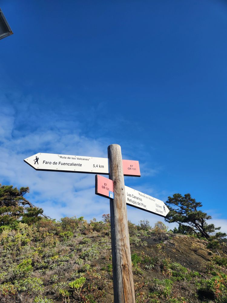
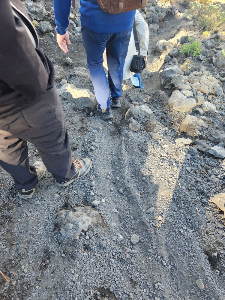
Evian first explains the hike, telling us it is strenuous and can be very slippery as we will be mostly walking over little volcanic rock pebbles, in some areas that are over 1 foot deep, and footing can be challenging. We are beginning at the top of the volcano and walking down to the Faro de Fuencaliente almost at sea level, a little more than 500m or over 1600 feet. This should be interesting!
During our 30-minute drive to the Volcano, Evian gives us a history of the island, tells us that agriculture and fishing are the main industries here, and that there are 2 sides of the island: The west, where we are, which is a garden paradise and the east, which is barren and rocky. Over 90% of the agriculture here is bananas, there are farm everywhere, and I am desperately hoping that someone from the ship went out and bought some of these bananas, because I need my potassium fix and there is nary a banana to be had anywhere.
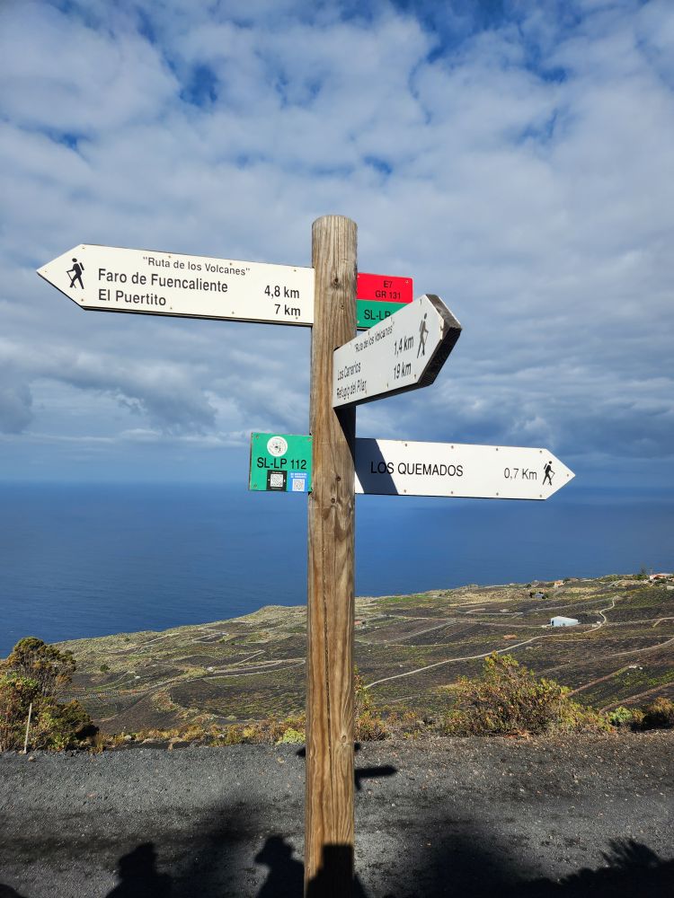
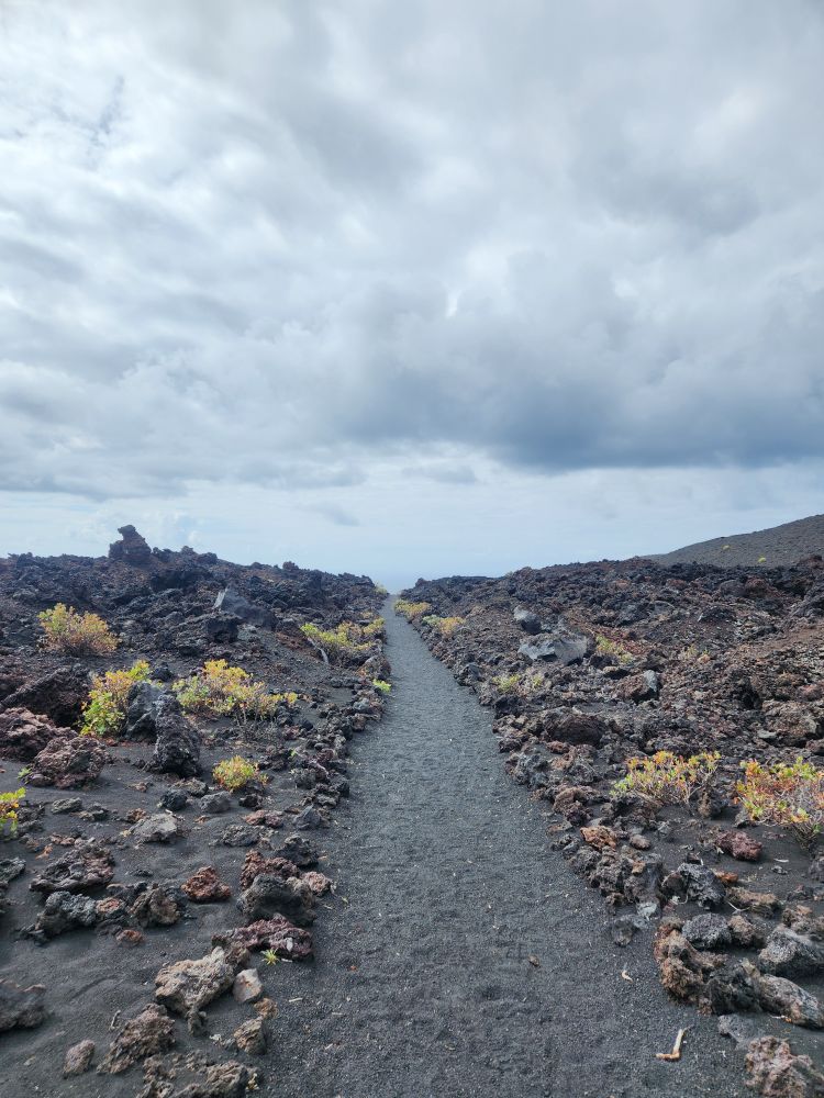
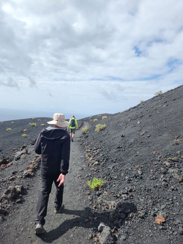
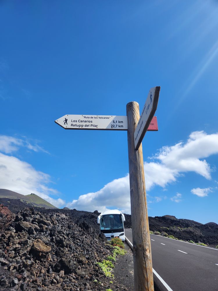
Driving along the coast, we go higher and higher, until we reach the Volcano visitor’s center, where our hike will begin. It is a relative short one – only 5.4K or about 3.5 miles – but it will be taxing going downhill virtually the whole time on the rocks. Once at the trailhead, Evian gives us more instructions – keep your eyes on the trail, make sure you know where your footing is at all times, keep separation so if one person falls, they don’t cause the domino effect, and as Evian says, turn him into a meatball! If you want to enjoy the view or take pictures, then just stop and take it all in – don’t try to do it while walking. Then he shoos us on down the path, saying he’ll be in the back to see how we are doing. Game on!
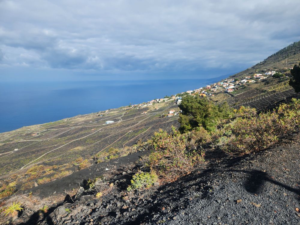
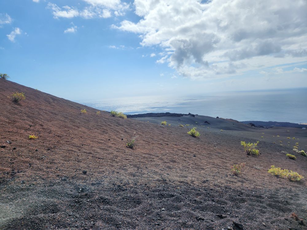
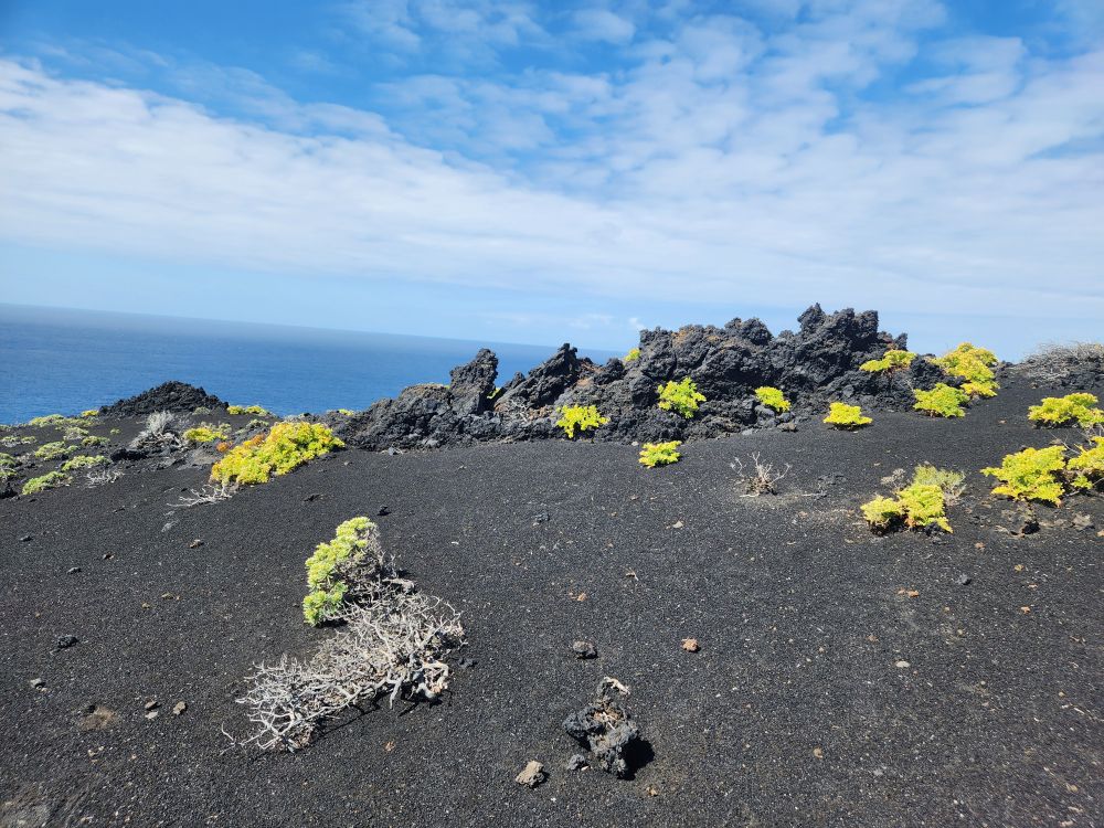
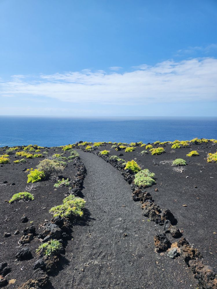
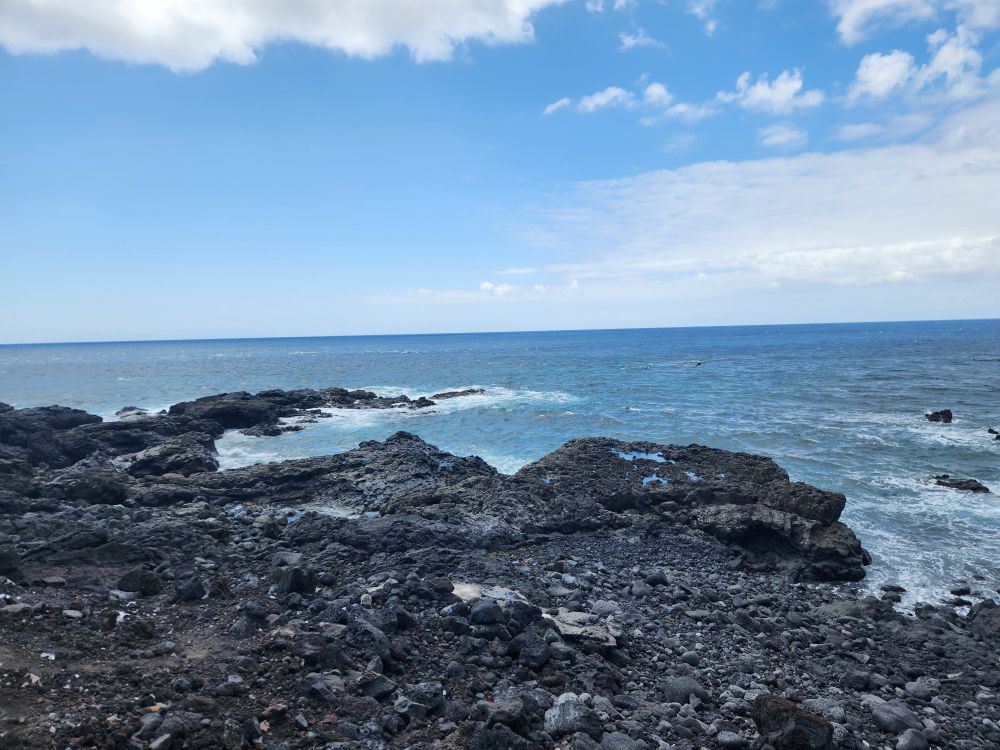
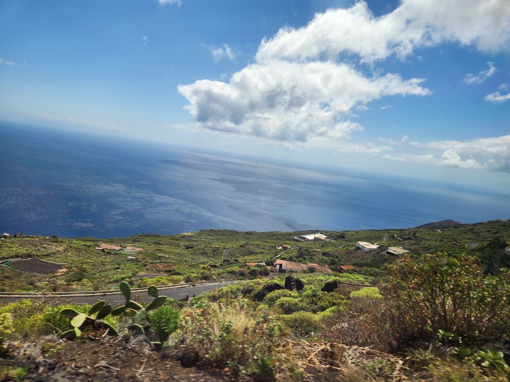
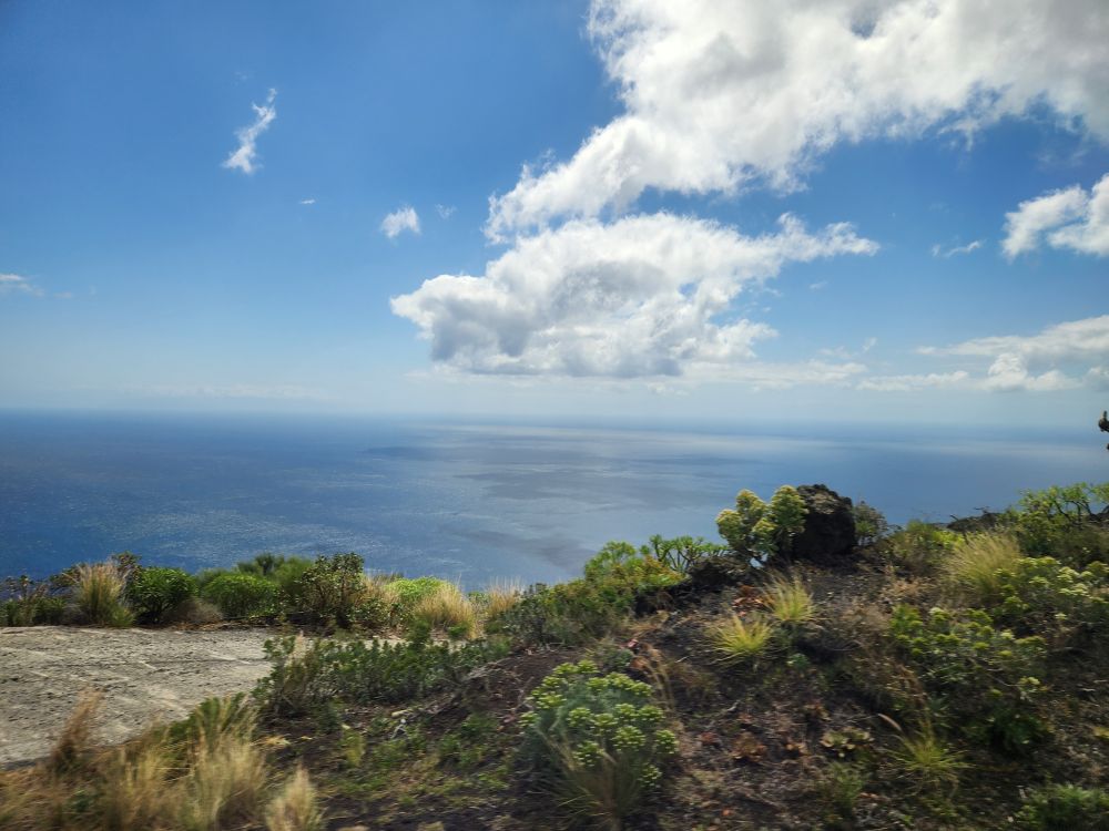
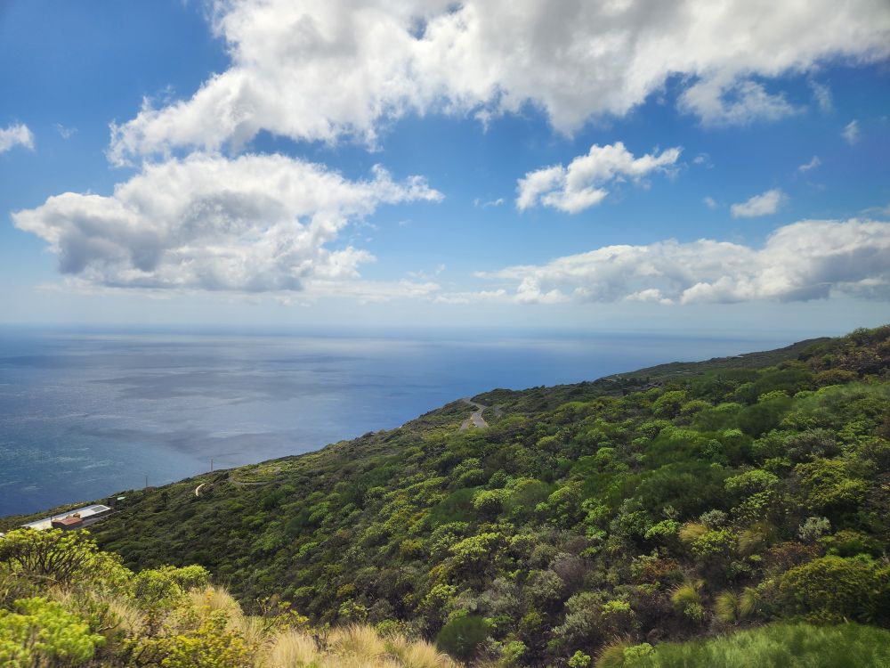
Together with our Denmark friends we head down the trail following the another couple and watching where they walk to see if there are any pitfalls here and there. It is strenuous, and taxing, because you have to stay focused all the time. Nobody wants to be the starting domino, or even fall on these little lava rocks because, as Evian says, they have fangs and bite! We fail to take Evian’s advice about the separation, but fortunately there are no dominos on this section. And of course, I totally ignore his advice on stopping for the photos – I’m not losing my place in line! – snapping pictures the whole way down this section of trail. And who can resist this scenery. It is stunning looking out across the rich soil slopes and down to the water.
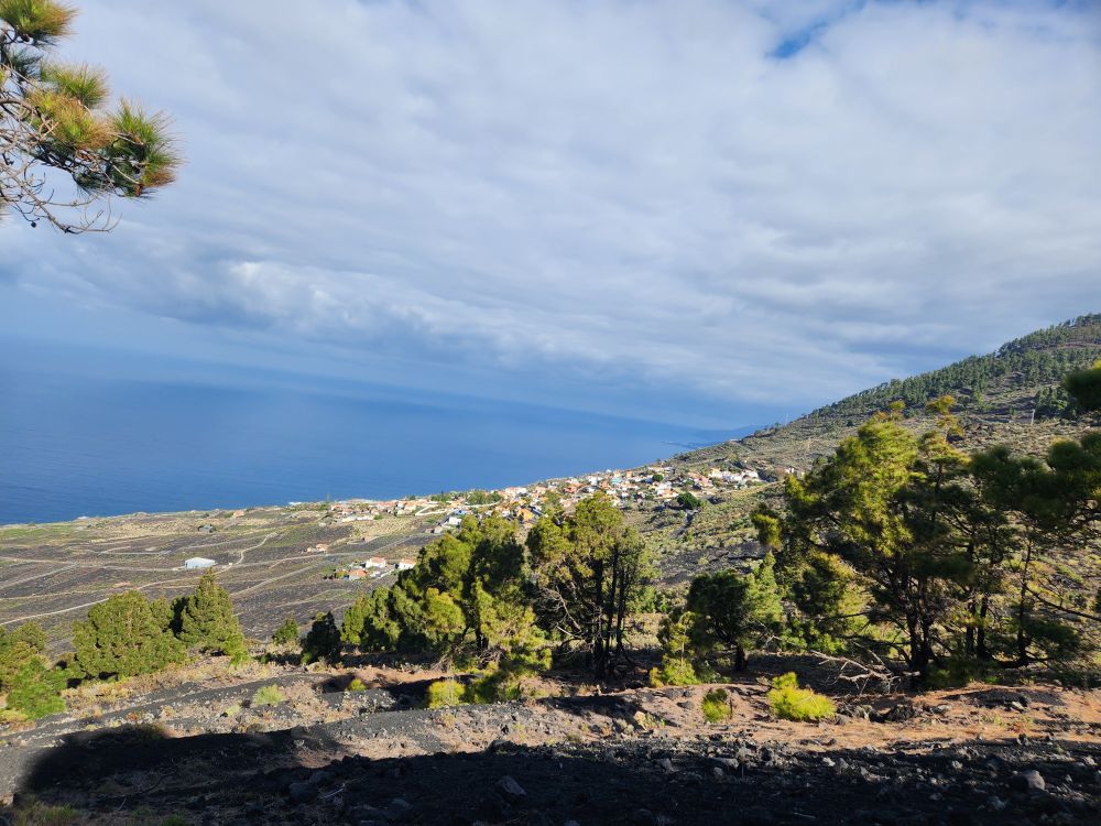
Arriving at the bottom of our first hill, we find we’ve only hiked about ½ a KM. It sure seemed longer than that – but apparently not. We’re only 1/10th of the way. And we don’t have a lot of time. Evian has made it clear we are doing this hike fast because we have such an early departure time. Of course we have stragglers who take a good 5 minutes more to get down the hill, which gives us plenty of time to absorb the gorgeous views and take pictures of the slopes, the water and the trails.
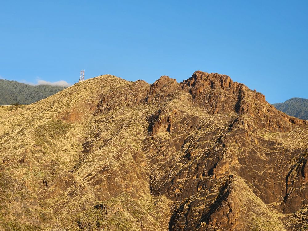
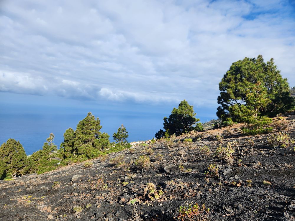
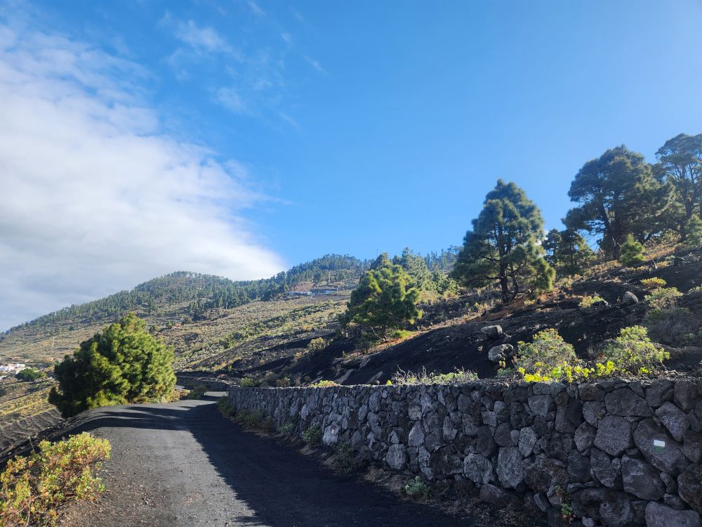
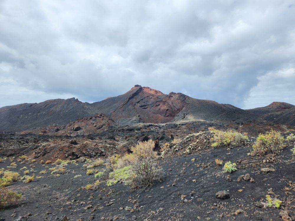
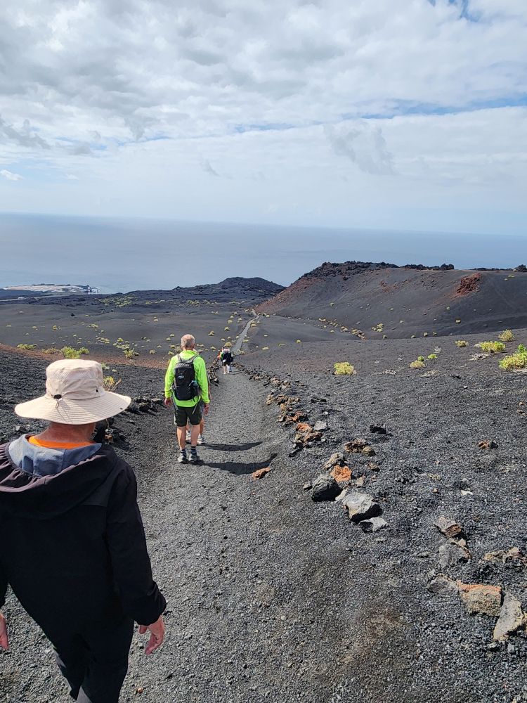
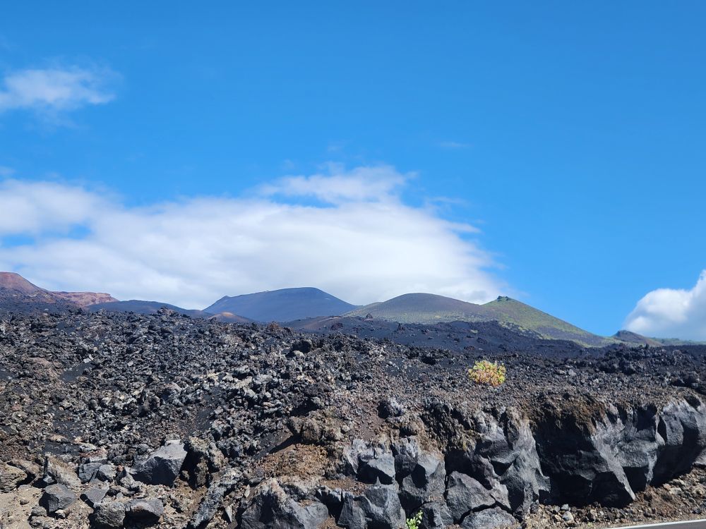
The next section of the hike is on a flat and relatively hard packed road – a short reprieve for us – but one that gives us plenty of views across the volcanic rock hills and up to the summit towering above us.
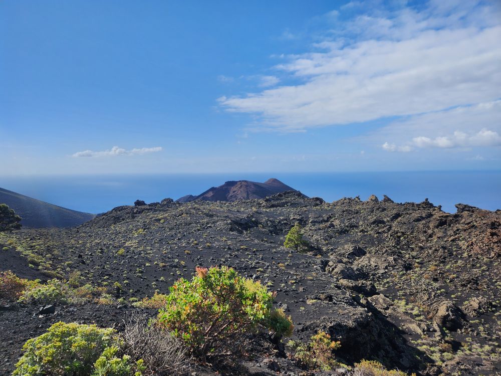
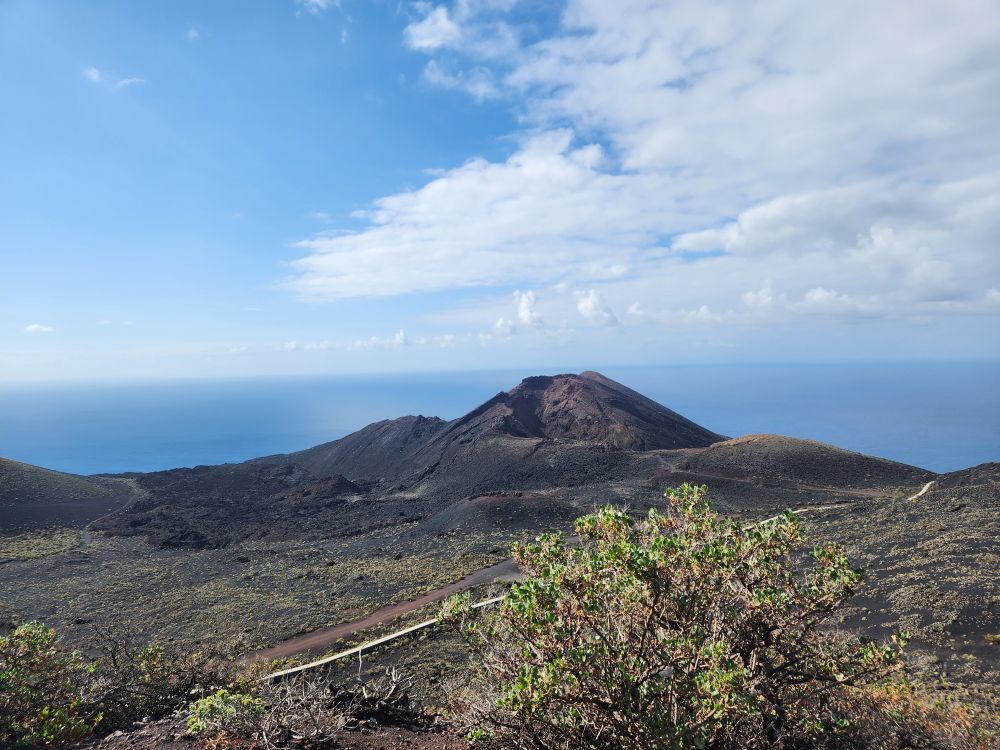
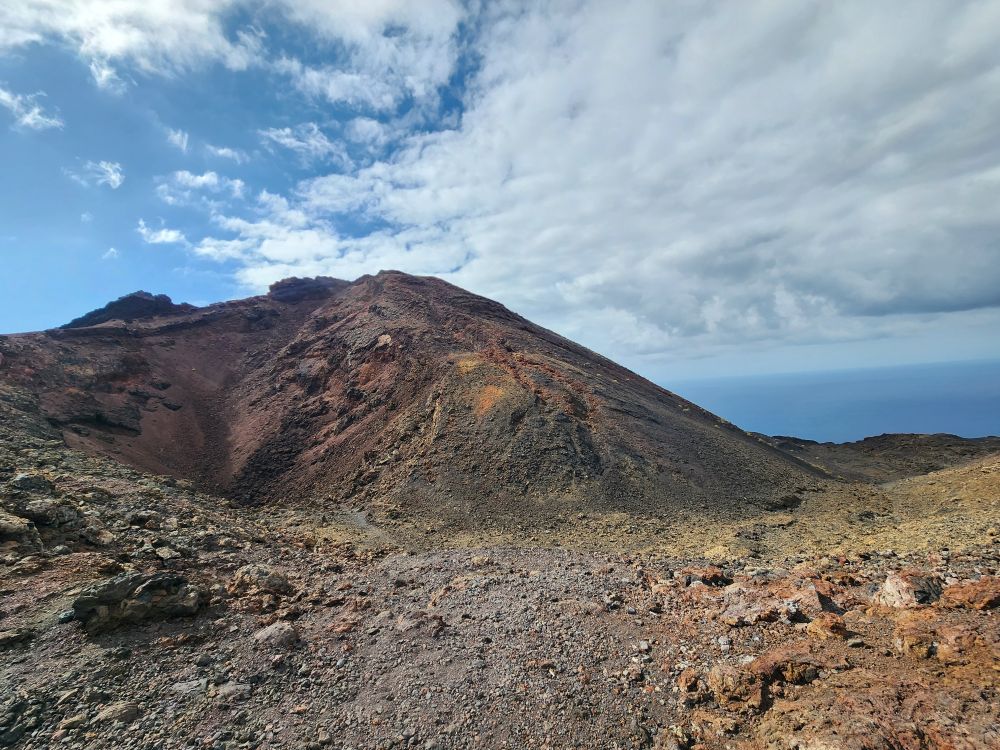
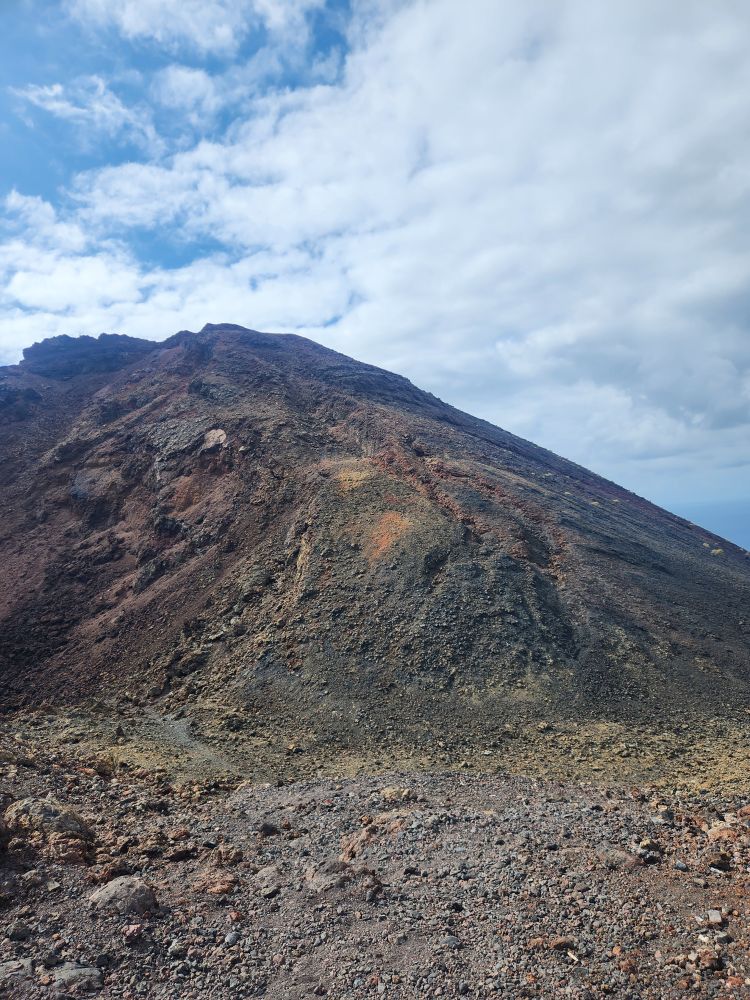
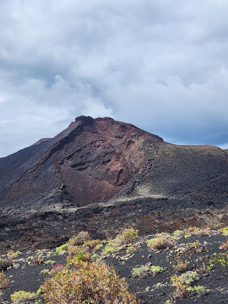
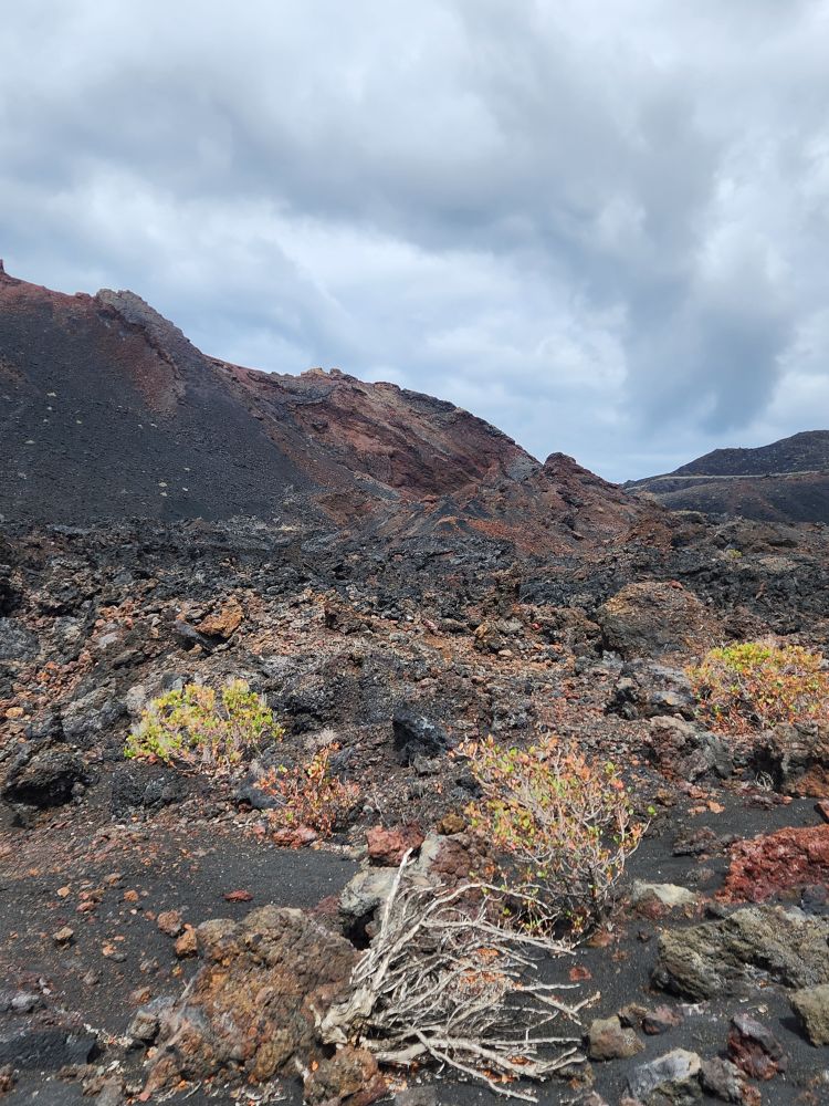
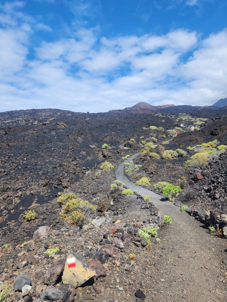
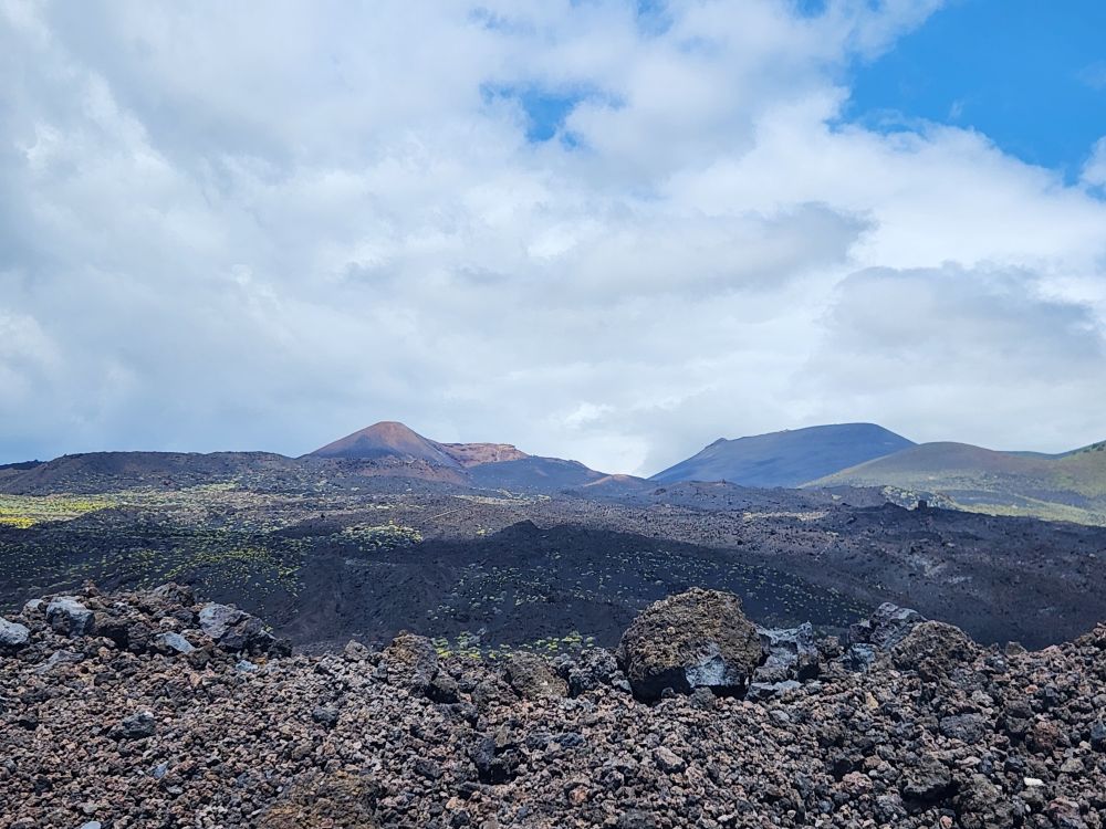
Stopping to gather our group – they are all strung out down the road – we are assuming they were taking pictures, which is why they are so far behind, but who knows? If they don’t walk faster we are for certain not going to make it back in time! – Evian directs us down a side path that leads to the Teneguia volcano. When we get close you can see the main fissure and where the 2 other little eruptions took place during the last eruption in 1971. The eruption looked like fireworks, according to Evian, and everyone on the island came to see it, and picnic and party here to watch the show. It made people complacent, they were no longer worried about eruptions because it was so minor, which led them to develop the coastal area here with a big shoreside community. Then in 2021, the Cumbre Vieja volcano erupting, covering over 100 hectares (250 acres), destroying more than 180 homes, 300 farm buildings and displacing 6,500 people. They aren’t so complacent about volcanoes here any longer, sad to say.
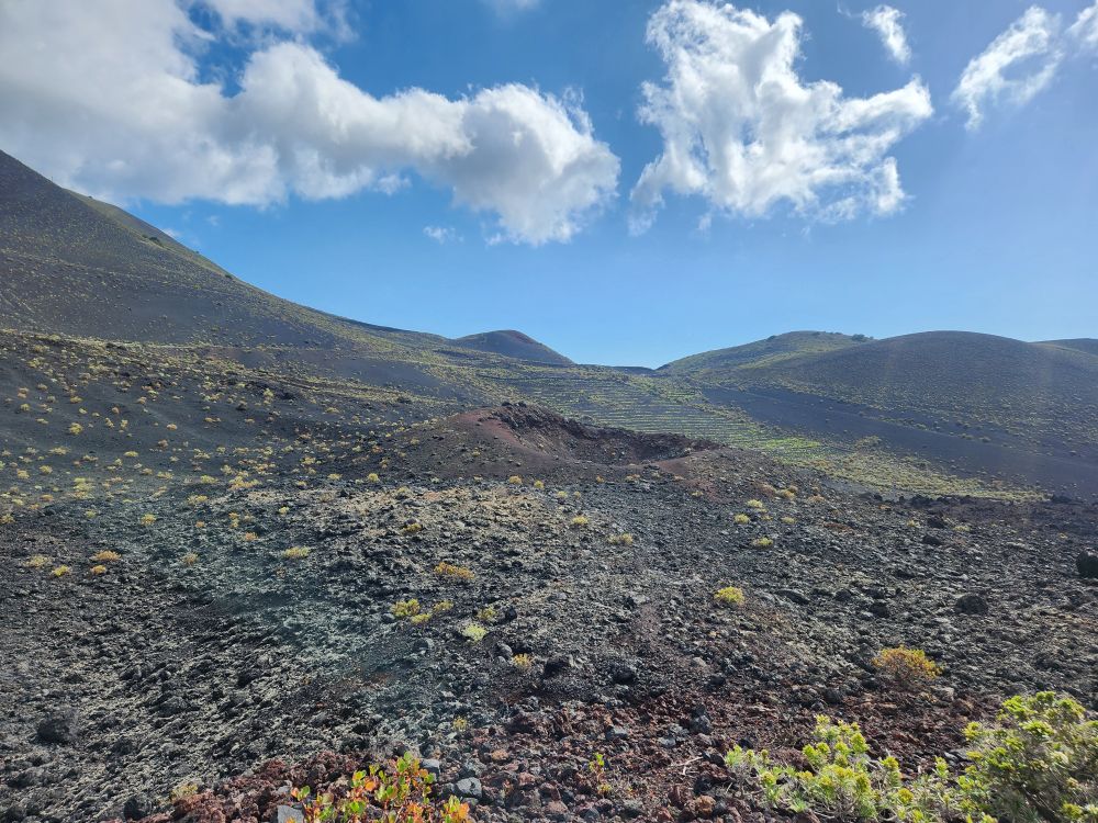
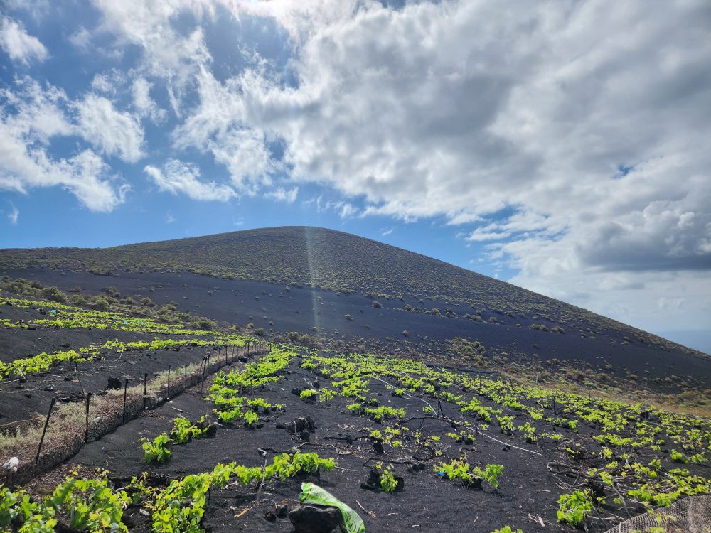
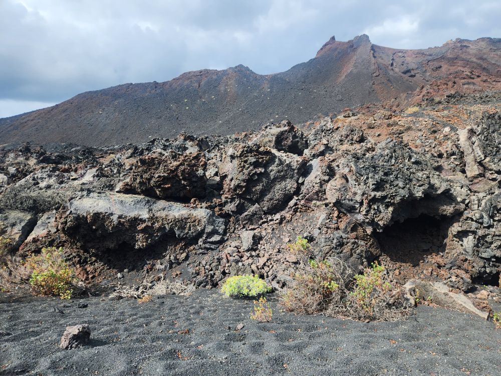
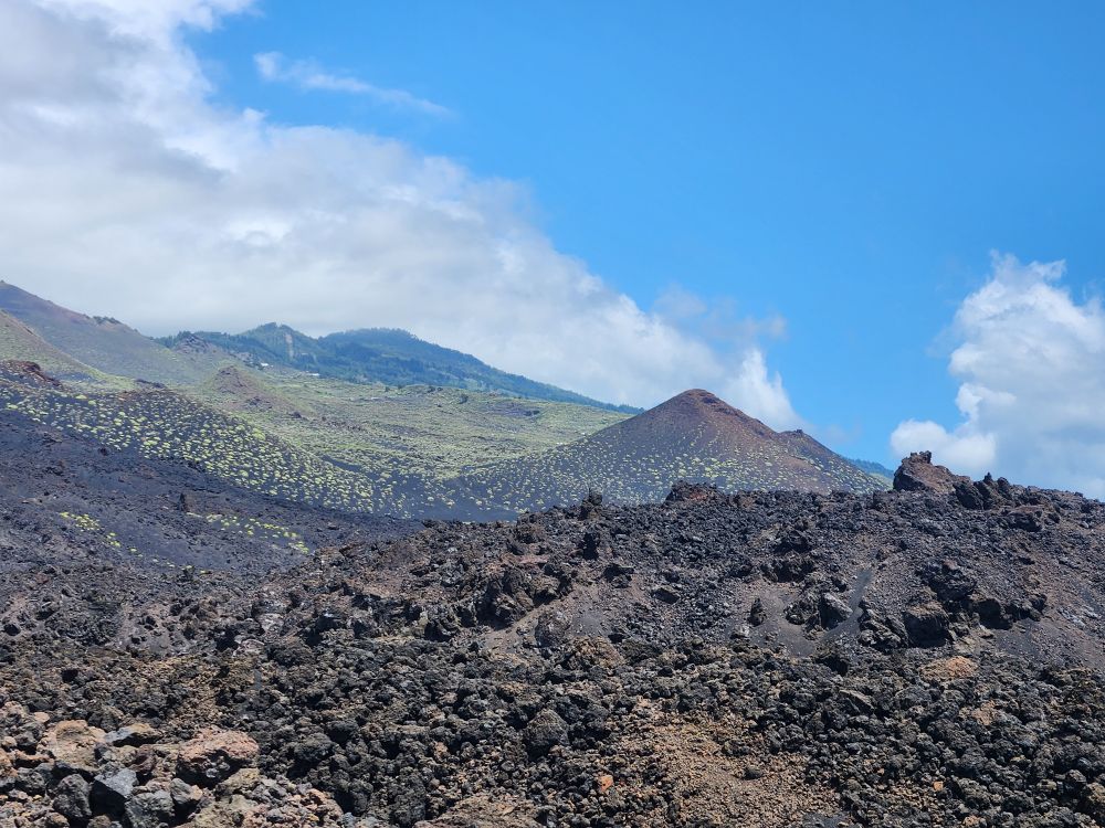
Heading back to the main path, we stop at a vineyard, one of the many you see dotting the landscape here. This is a special type of vine, very ancient, called Malvasia. The vines actually lay on, and spread out directly on, the volcanic soil. There was a huge trade in wine in the early colonial days when the Canarians figured out they could make and produce the wine quicker than their European counterparts, which gave them an edge when it came to selling and exporting. Now, because there hasn’t been significant rain in a couple of years, the vines are dying out and vineyards are trying valiantly to save them with irrigation and other tactics. A little ways further on, we stop in front of a small lava tube while Evian explains they used to have tours through the major lava tubes around the area, but they have been stopped for some reason (didn’t hear if it was safety or because of COVID).
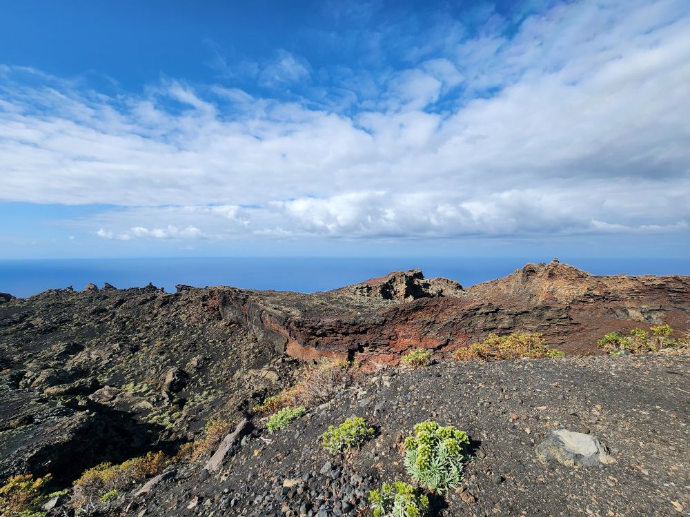
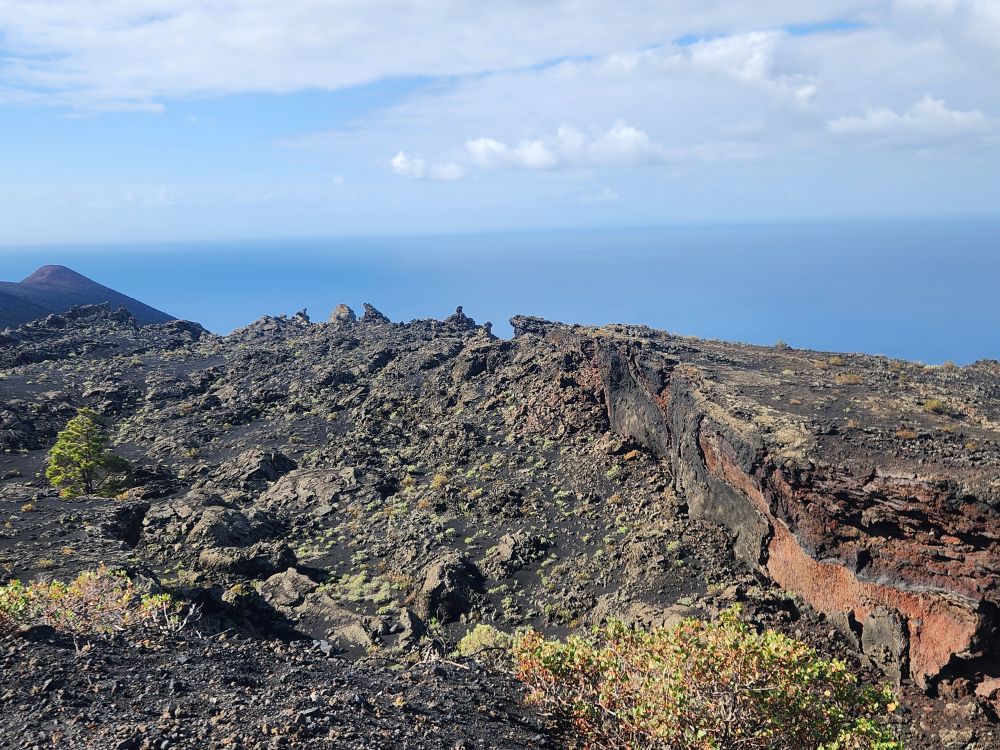
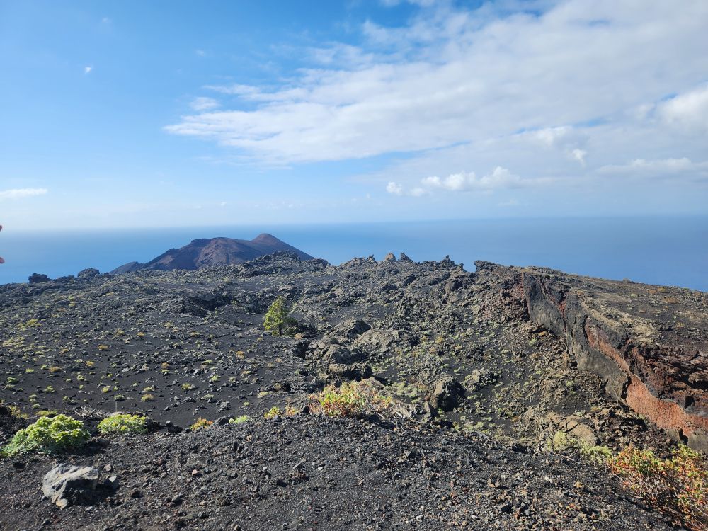
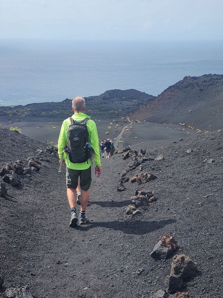
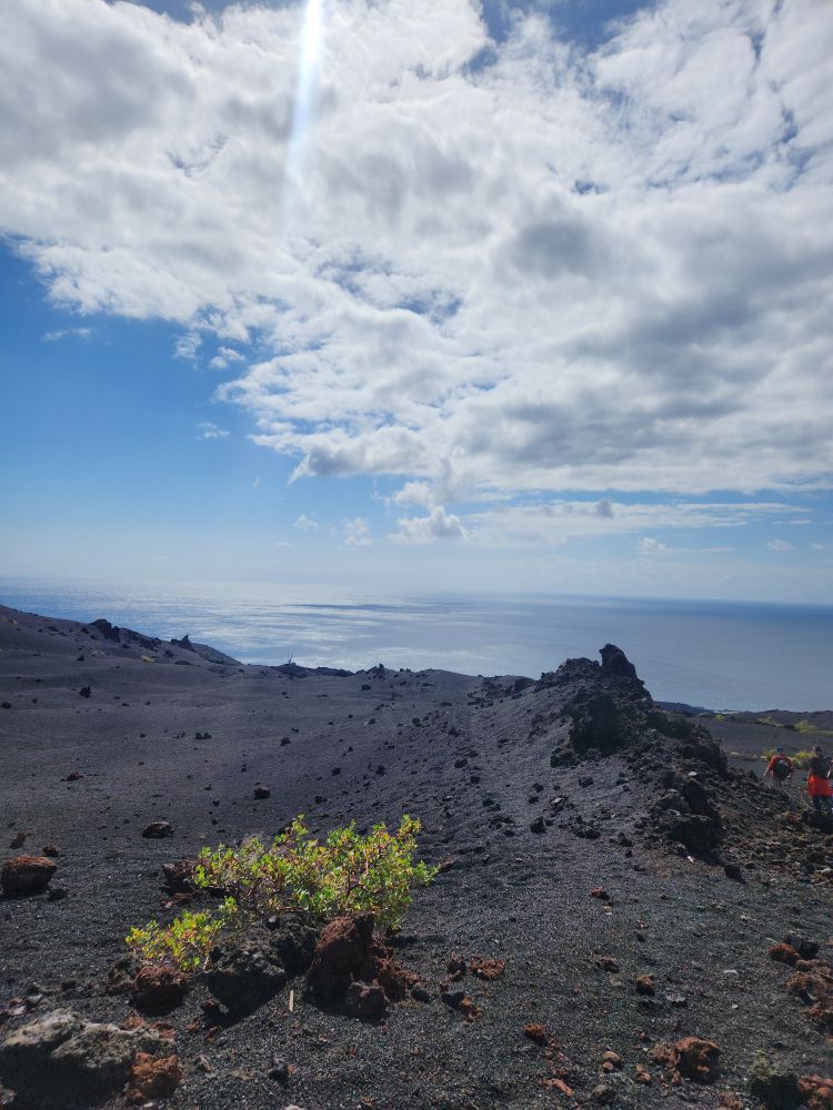
Then we proceed on, down the lava rock trail, through spectacular scenery that just keeps getting better and better! I am still ignoring the don’t take pictures while you walk advice. We are still up front with our Denmark friends in the lead, and don’t want to fall behind some of these slow pokes in the back. Plus, being up front you get clear unobstructed views – and you can take videos as you walk, crunch, crunching along the trail! Ed is chastising me (fortunately you can’t hear that on the video) but again, I’m watching where I walk, just while holding the camera up and videoing off the side.
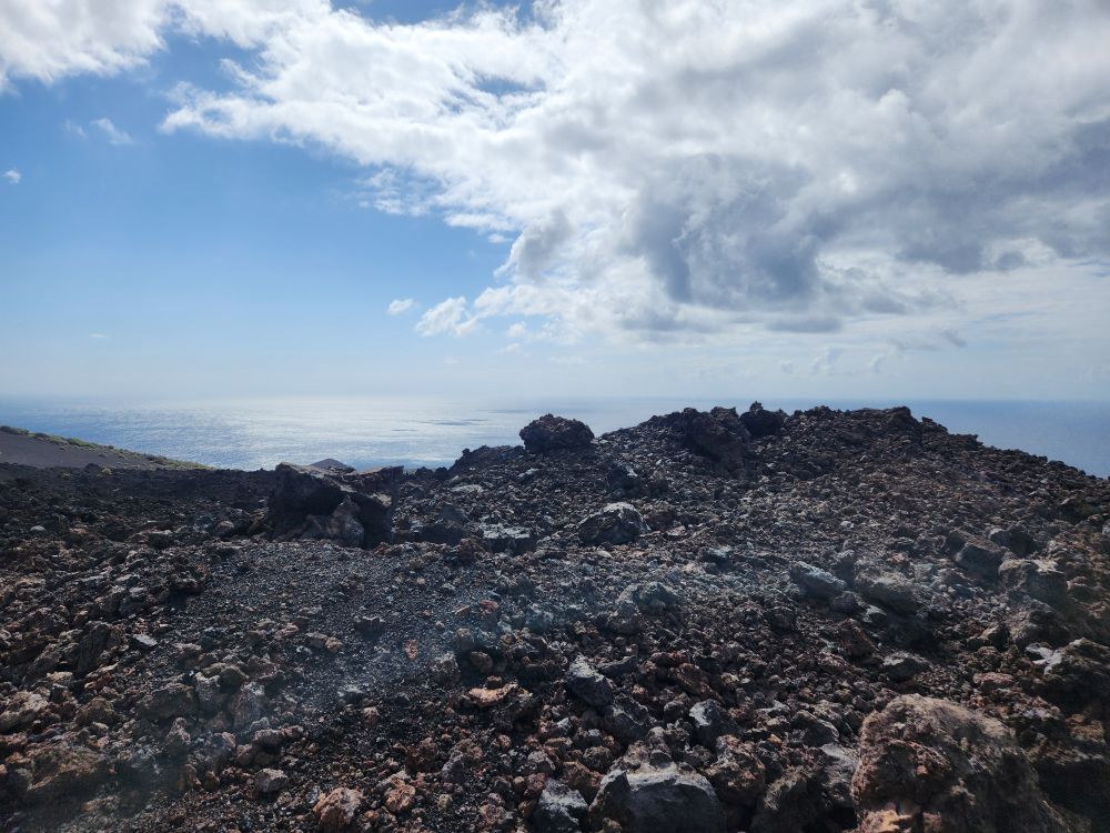
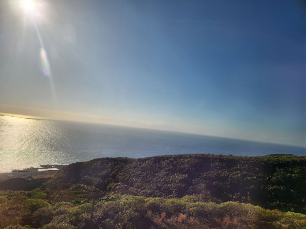
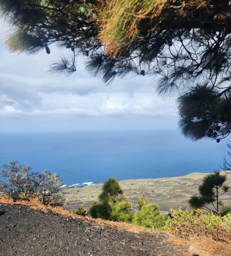
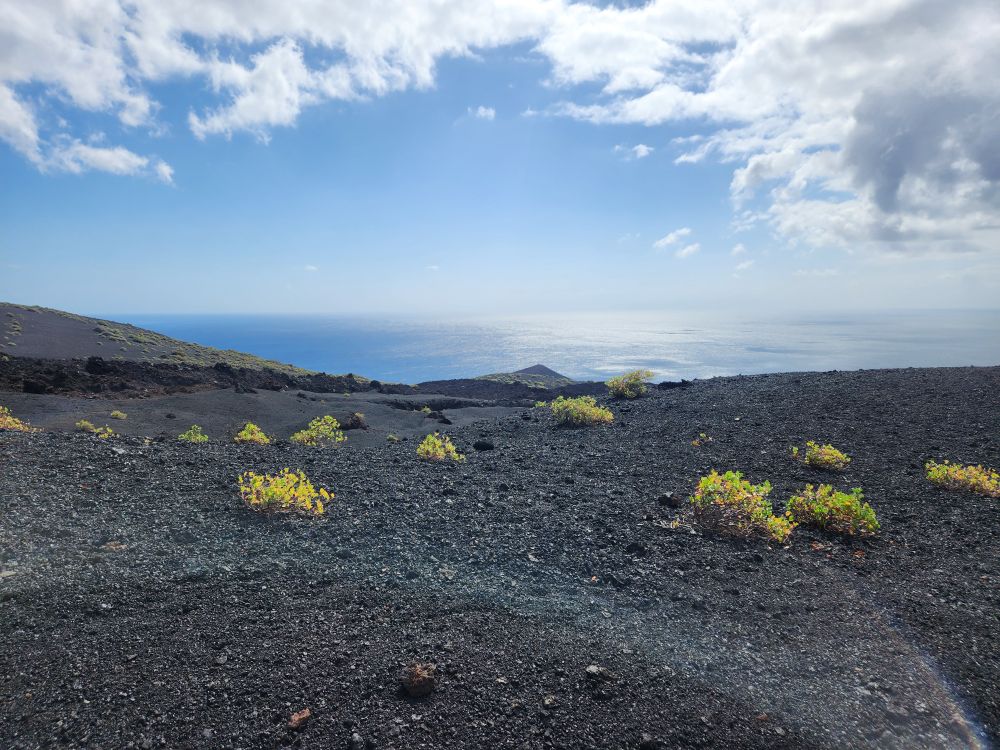
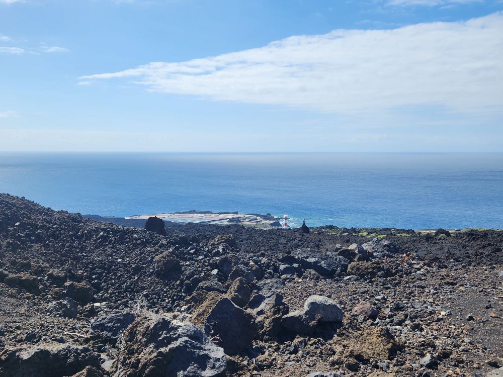
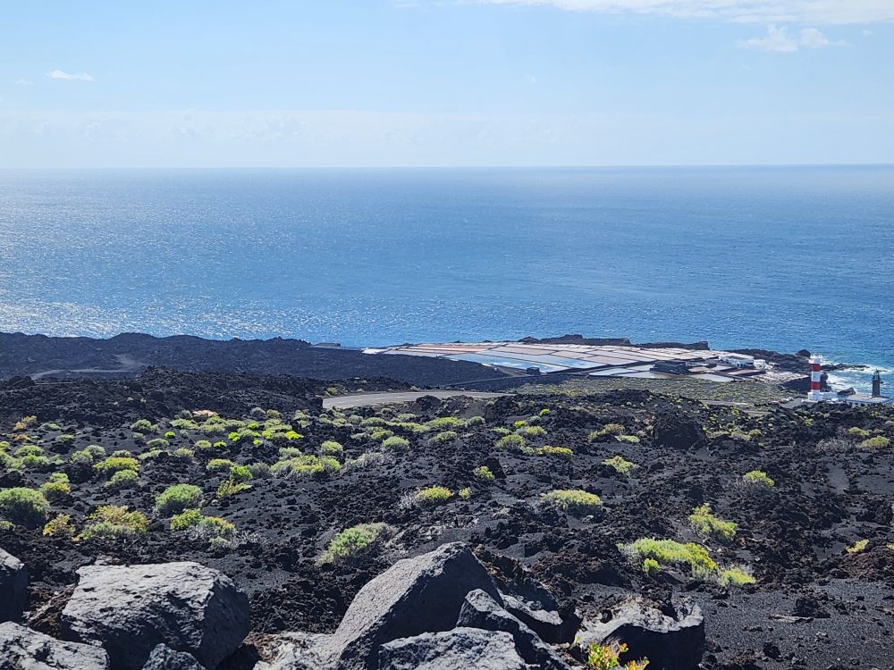
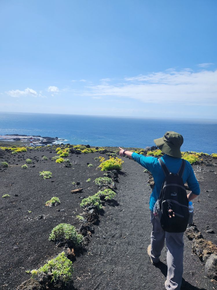
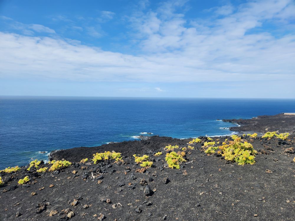
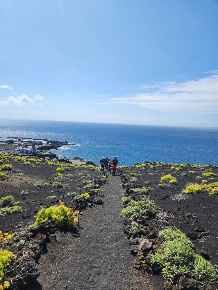
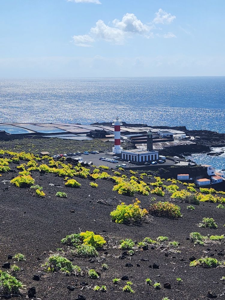
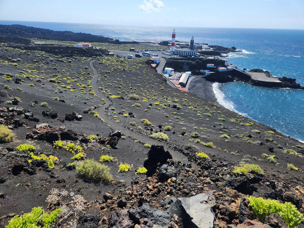
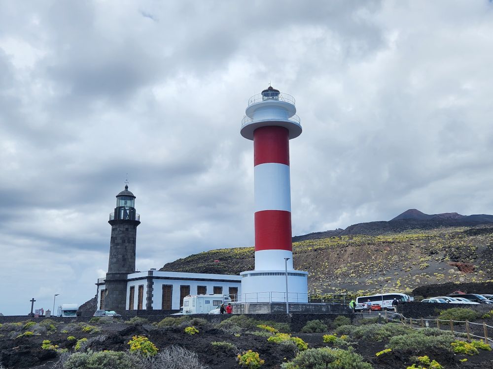
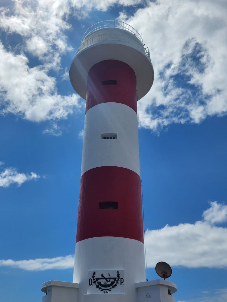
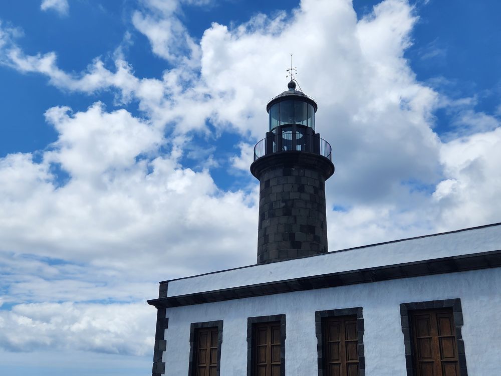
Cresting a ridge, we are treated with fabulous views out to the ocean, a wide blue contrast to the brown and black lava soil hills rising above us. And we finally can see the lighthouse as well! Our destination is right down there over the big hill we must now ascend. Too cool!
We actually come upon another group of hikers we had seen in front of us way back at the volcano crater viewpoint. Obviously our pace is much faster than theirs, which is one reason this hike is so great! Evian and the whole hike so far has been at our speed and not an ambling, oh we have to walk slow for the people who really shouldn’t be on this tour speed. The four of us in the front rachet down the speed a little and follow these guys down the trail to the road where we will wait for Evian and the rest of the group.
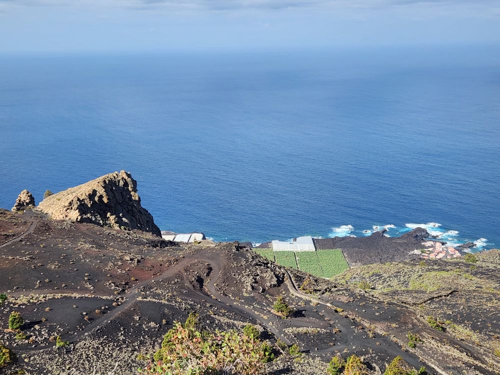
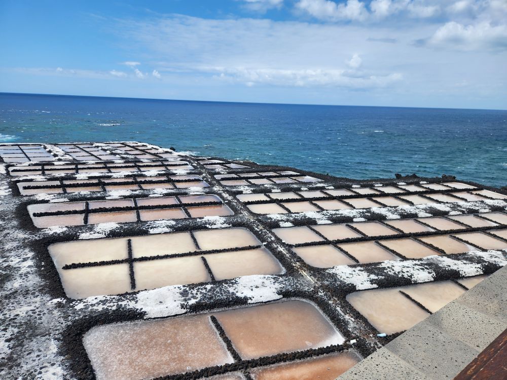
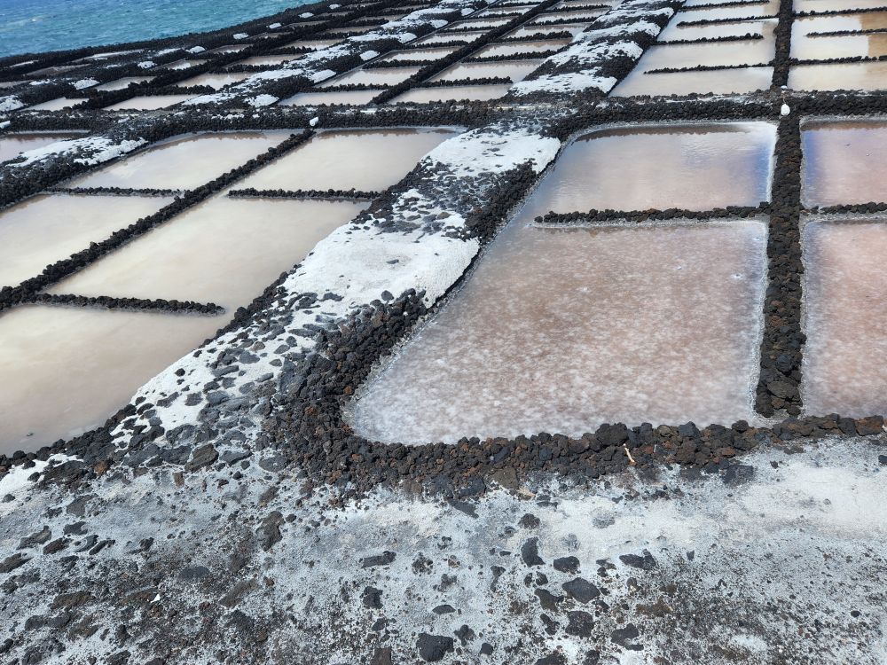
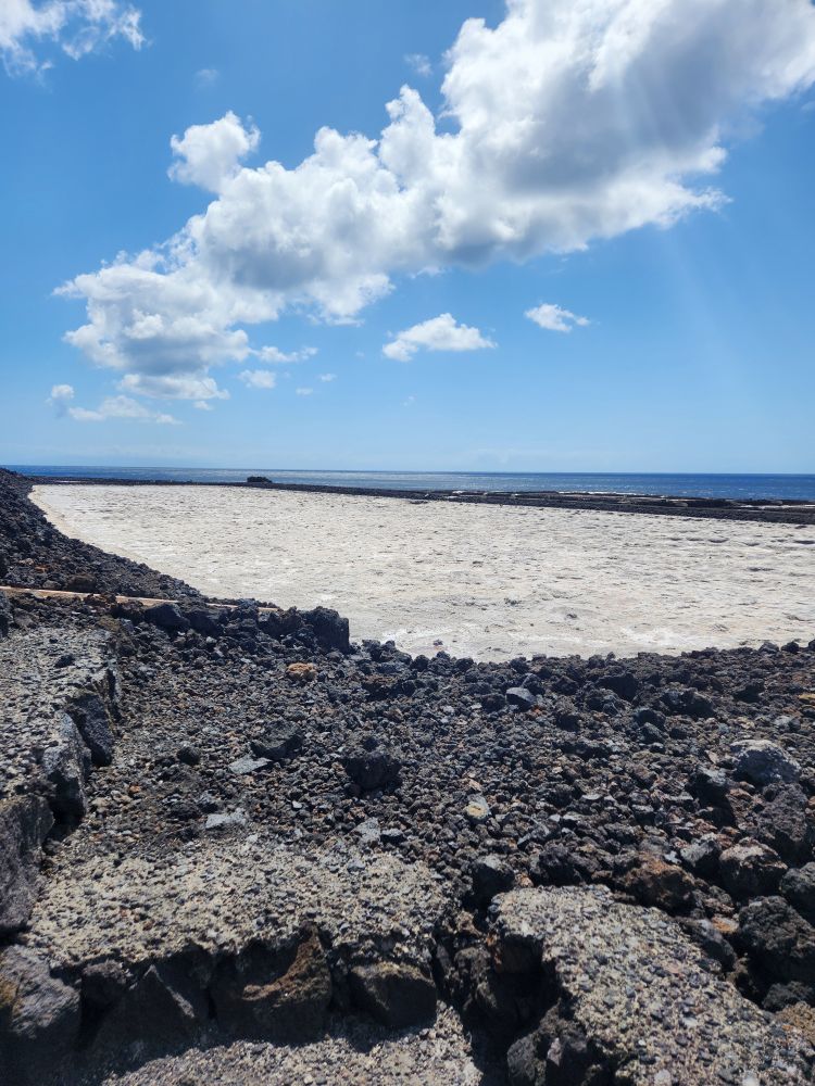
The bus is waiting at the meeting point as well, presumably for anyone who doesn’t want to continue the trek down to the lighthouse, but no one takes Evian up on his offer, so we continue on, now in the lead. First on a very flat part of the trail, then down an even steeper path where we really need to be careful. All the while admiring the views out to the ocean and back up into the hills. The Fuencaliente Salines, or salt pans, are right beside the lighthouse, and you can see clearly how lucky they were that the lava flow from the 1971 eruption stopped right at the fence of their uppermost salt ponds. The owners were so relieved, they built a chapel at the end of the lava flow to show their thanks to God.
Once more road to cross, then the last portion of the trail which is really treacherous at the top with jagged rocks being used as “stairs” to get down to the flatter part of the trail. Fortunately we are right behind the other group of hikers and their guide, so we watch them as they go down to figure out where to step, and are all the way down at sea level in no time at all. Phew! That was a great hike! 2 ½ hours of solid, heavy duty hiking. Totally fun. Totally and us day – even if we are with a tour group!
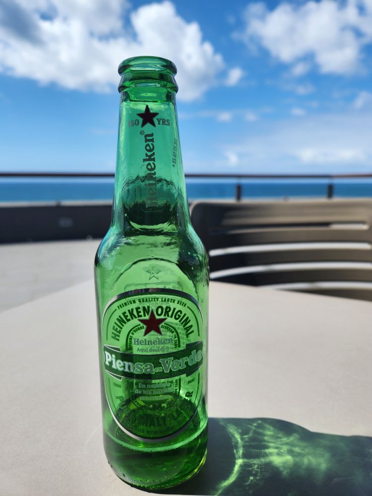
Behind the lighthouse is a gift shop and restaurant/café where Evian said we could have a beer at the end of our hike. Works for us! We have 1 hour here to rest and relax, so we wander through the giftshop, buying 2 small Piensa ca Verde (a Heineken brand – what isn’t own by a major brand these days?) and a bag of local sweet potato chips to munch on while we relax on the not-open-yet restaurant patio.
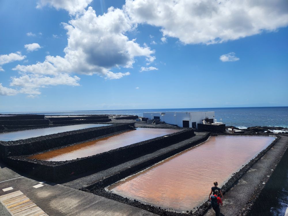
Finishing our beer, we still have loads of time, so we go back and shop a bit in the store wishing we could bring back some of the salt – even though it was so inexpensive! – but knowing we have tons at home right now anyway. Then we go and explore the salt pans, which are the only working salt pans in the province and quite an operation. As well as photogenic. There is a self-guided tour, which we halfway do, that explains the process and each pan we are looking at, as well as the birds and organisms the salt pans maintain.
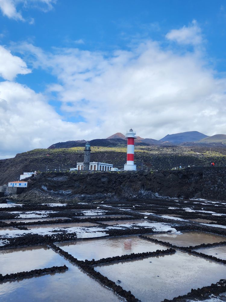
Back up in the parking lot, we snap a couple of last pictures of the lighthouses and are quickly on our way back to the ship, winding our way through narrow, curving mountain roads with spectacular views out to the sea.
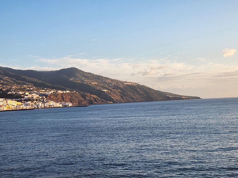
Our tour is the last to arrive back at the ship, and we are the last people aboard, fortunately with a couple minutes to spare. Since lunch was not included on this tour, and we had no time for it anyway since the restaurant at the lighthouse was not opened yet, we head upstairs for lunch – OMG, it is a zoo review. There isn’t a seat to be had! We end up at the Sunset bar in the last 2 seats and eat what little lunch we could grab off the buffet (that too was hammered with too many people wandering about trying to get even more food) with Mark, who is super-slammed busy. And then we are off – sailing away from the gorgeous La Palma, on our way to Tenerife.