
We arrive outside at the appointed hour and Seeva is right there waiting for us. We know better than to bring my umbrella today, so we’ve thankfully lightened the back pack load. But we do bring 2 bottles of electrolytes so we won’t get dehydrated. After yesterday, we’re taking no chances!
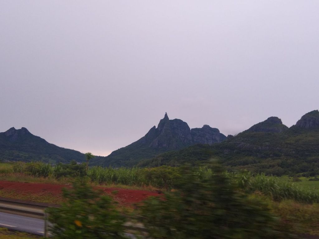
As we leave the port, Seeva tells us we are going north to go south – looking at the traffic that’s a darn good decision because it is bumper to bumper going south into Port Louis. He says we’d sit in that traffic for over an hour trying to go that way so we’re taking a detour up north a few miles to catch the M3 (I think) to take us back to the M2 to the south. Hey – we’re all yours, whatever you say goes. And wow, what a good decision, the traffic goes on for absolutely ever! We circle around it on the M2, watching the mountains in the center of the island grow closer, and passing close by Pieter Both, the 2nd highest mountain peak in Mauritius. It is a craggy steep peak, topped with this oddly shaped rock that almost looks like head atop a priest’s frock. Totally odd! It must be a terribly hard climb, which Seeva confirms telling us he’s done it and it is tough. No doubt, we’ve no idea how you’d get to the top of that thing!
Soon we’re leaving the mountain behind and as we are heading toward Curepipe, one of the largest cities in Mauritius, Seeva once again takes a detour off the main road. We end up getting the best off the beaten track tour we could ever imagine! We drive through little towns and hamlets, sugar cane fields, past hills and other produce fields. It’s crazy, but he saves gobs of time by not using the motorway, because even here, the cars going the other way are all stacked up in traffic jams. Surprisingly enough, they are all going to Port Louis for work. What? Way out here? That is one heck of a commute. But, as per usual, that’s where all the good jobs are located, so people live out here more affordably and drive into town for work. Same same everywhere.
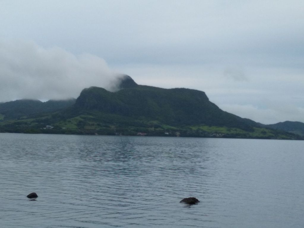
Reaching the airport, we drive past the end of the runway, where a plane is getting ready for take-off, but we’re on a mission to hit all our requested stopping points today, so there is no wasting time watching planes! One of the challenges for our touring today is that we want to go to Vieux Grand Port, the birthplace of Mauritius, and then to Mahebourg which was the original capital city (plus there is a market there that is supposed to be the best). This puts us farther east than the main sights in the south and adds about an hour to our drive times. But Seeva is nonplussed. He once again cuts off somewhere and we go cruising through open fields of the Ferney valley where the views across the fields to Lion Mountain are just gorgeous. The sea is way off ot our right, and the mountains ridges are surrounding us to our left and all is green and lush and beautiful.
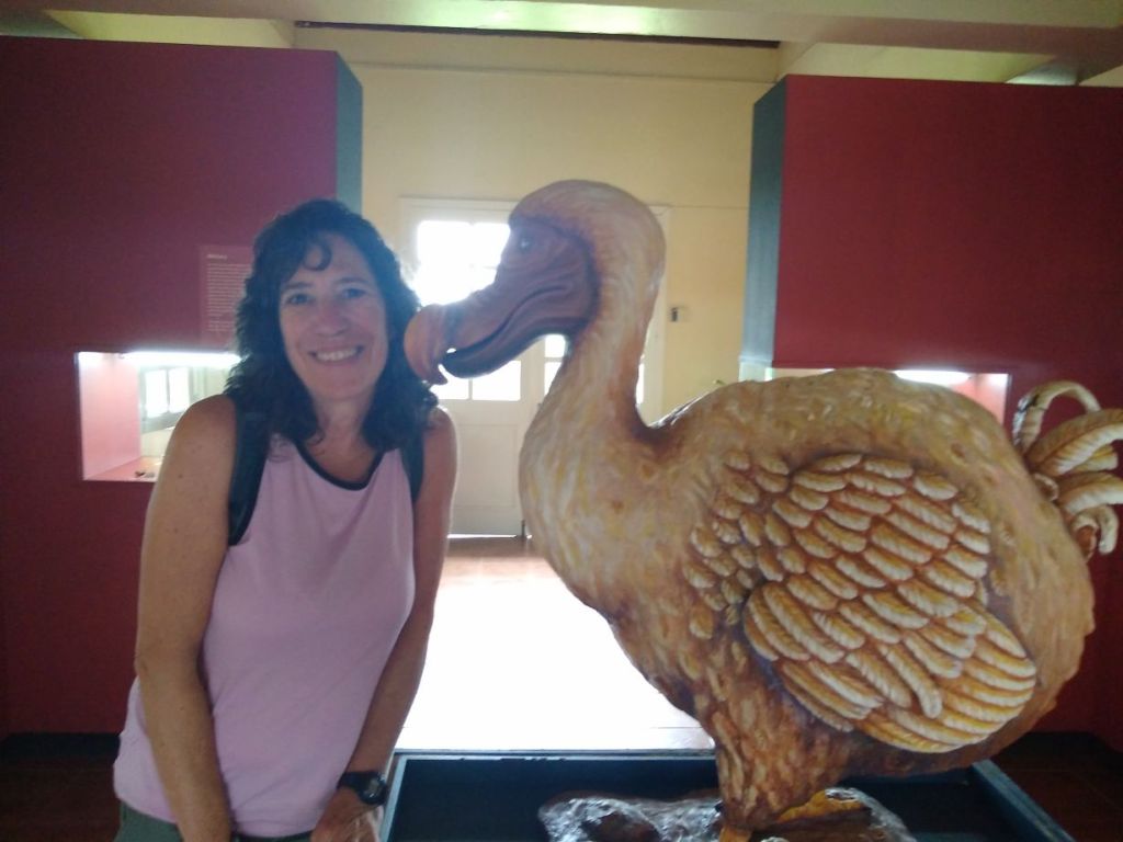
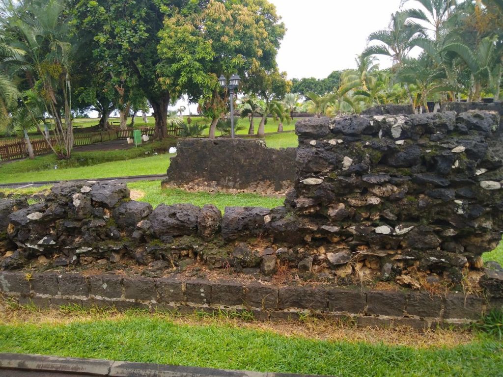
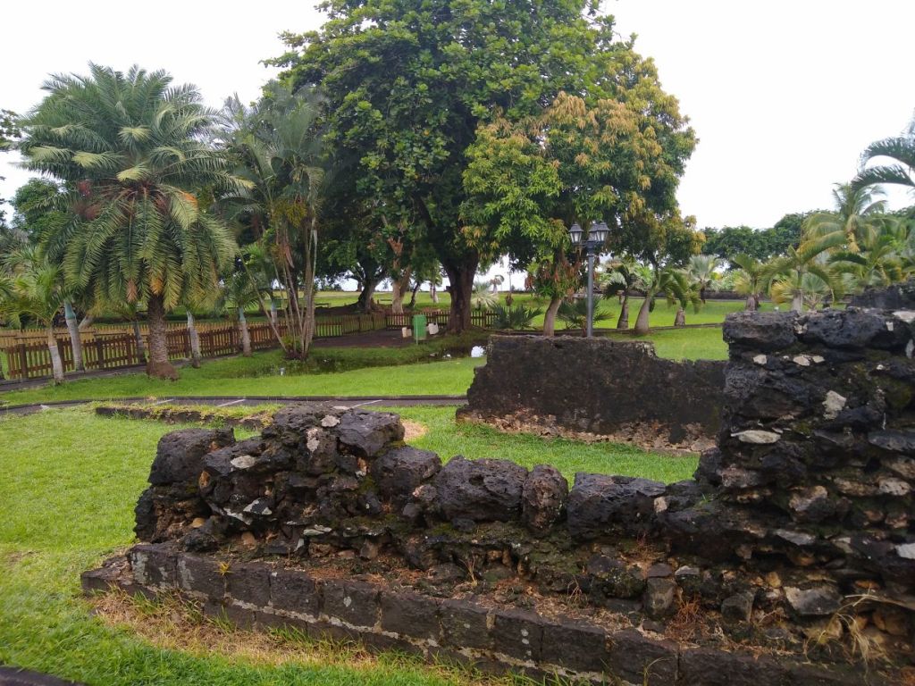
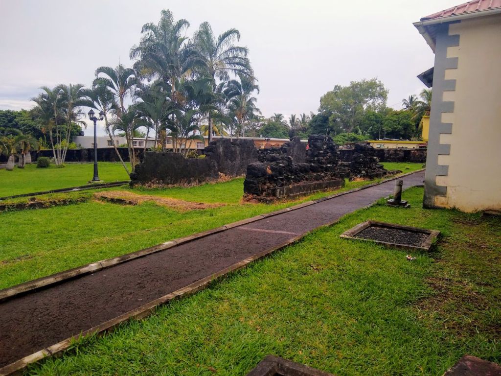
Driving through the little town of Vieux Grand Port, Seeva tells us that it was the first development here on the island, but that the people slowly moved the Mahebourg, draining this town of people and livelihood. It still exists today as a little village without much commerce. We stop at the small museum located at the site of the oldest colonial structures on the island. Inside, a series of small thoughtful exhibits tells the story of Mauritius. It is fascinating to read how the island was not inhabited until the 17th century when the Dutch came to this spot to begin a settlement to use as a refreshment station and defense of the Dutch East India Company’s trade routes. They built a fort and some support buildings, but only stayed for 20 years before being chased out by cyclones, pestilence, fires and threats from runaway slaves! They came back 6 years later (obviously with more fortified personnel) but still were plagued with problems – pirates from Madagascar, rats, caterpillars and locusts which ate the cargo, slave revolts – it all proved too much again, and in 1710 they decided Mauritius could never be self-sustaining and evacuated for good.
After that the French settled here, and what we see on the property are the remains of the French buildings constructed from the stones of the Dutch fort in the 1700s. Eventually the French moved the settlement to Mahebourg and then to Port Louis, where the capital city is currently. It’s a great lesson in Mauritian history, and a really pretty little place with lots of green grass and black stone building ruins.
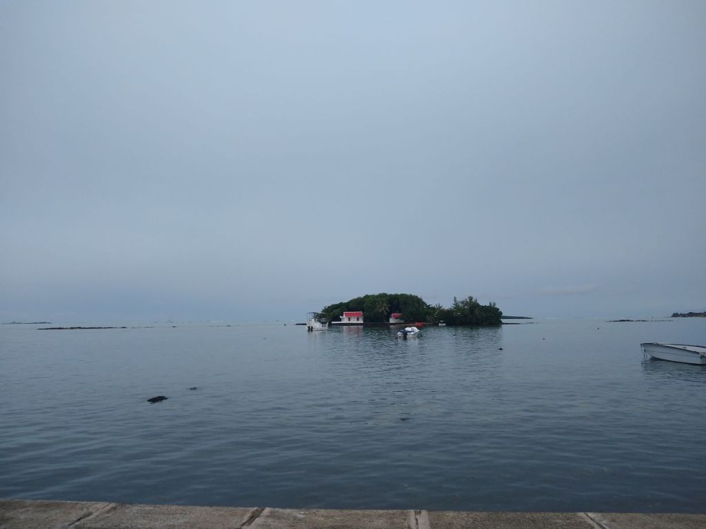
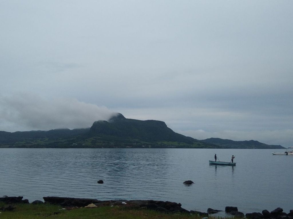
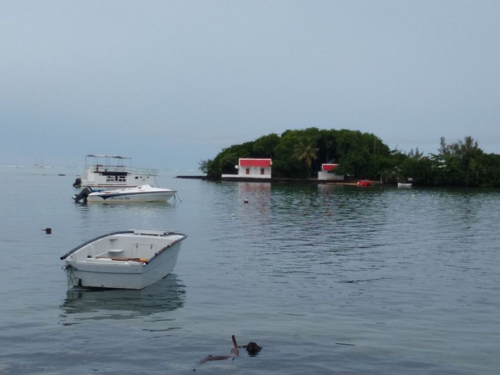
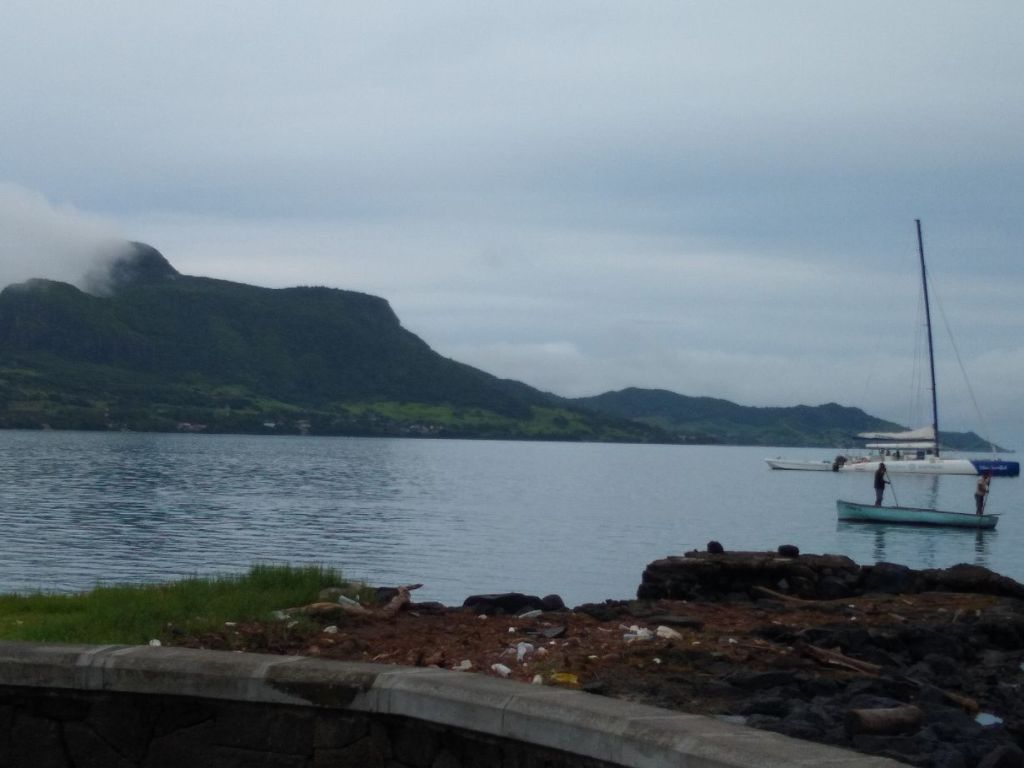
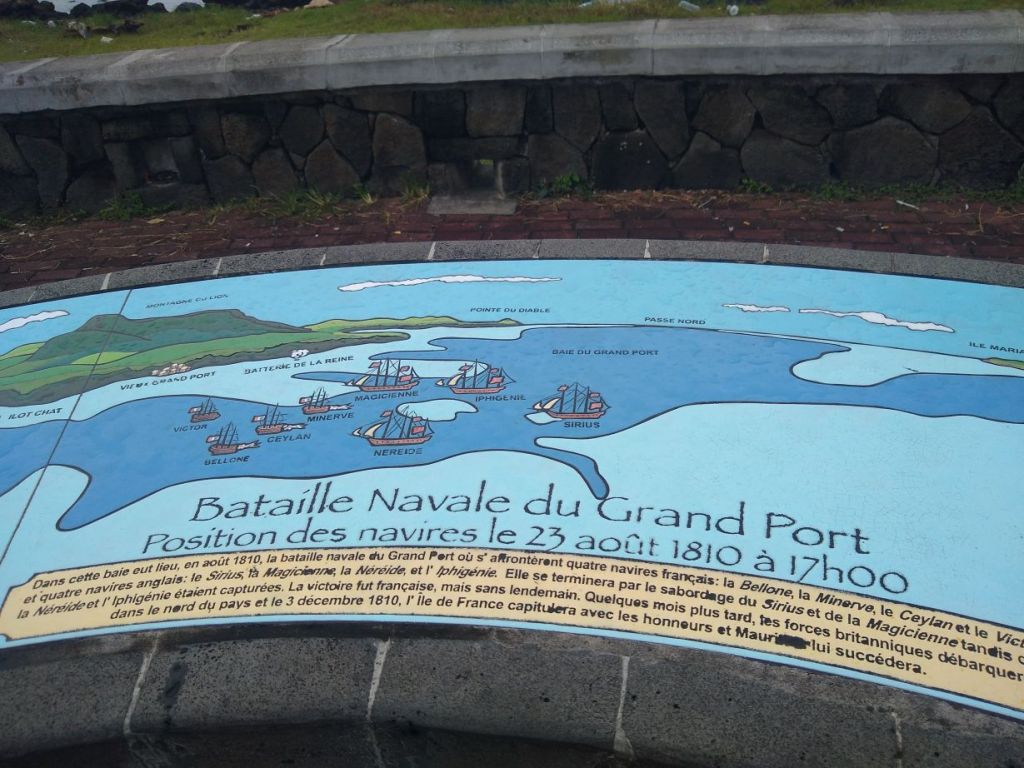
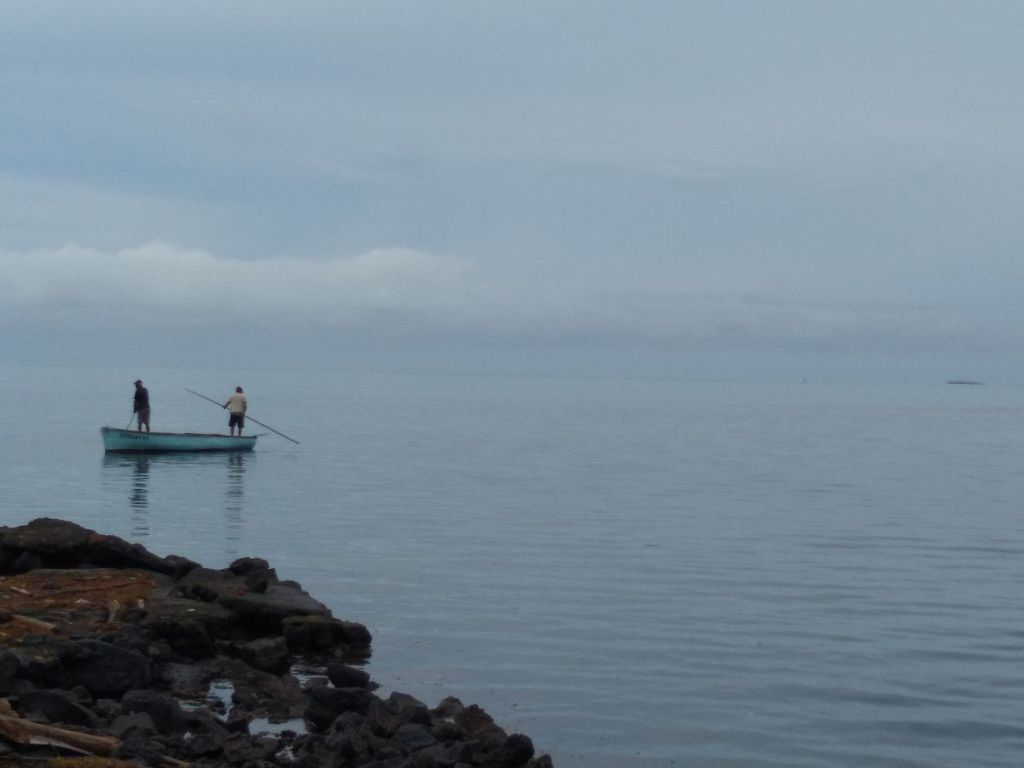
After about 15 minutes we are ready to move on to Mahebourg, which we find is Seeva’s hometown. He was born here and lived for most of his childhood here until the family moved to Port Louis. He’s very proud of his hometown and takes pride in showing us the waterfront and explaining how the battleships lined up in the bay during the French and English war. There’s a really nice stone carved depiction of the 1810 battle, which Seeva reviews with us. Aside from the historic perspective, the bay is a wonderfully beautiful place – maybe its just the way the water and sky are lit today, almost as if they are one and the same, blurring into each other on the horizon. Or it’s the way the clouds creep over Lion Mountain, or how a couple of fishermen glide by in their little boat. Or it’s the two women burning incense and praying at the water’s edge. Whatever it is, even though we know there is hustle and bustle just around the corner, you can just feel the peacefulness as we bask in the scenery.

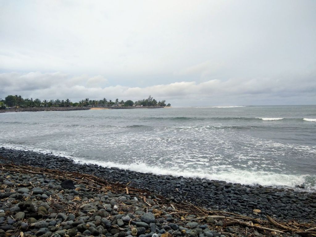
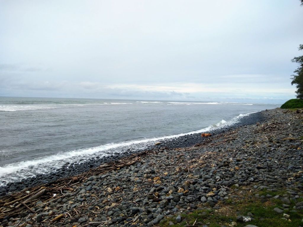
After our history lesson, we drive out of Mahebourg, right past the market – which is huge and bustling and I’m now very glad we didn’t stop! Because we “detoured” to Vieux Grand Port and Mahebourg, we are forced to drive through the southern valleys that lead to the mountains and along the coast line, through cute little villages and lovely scenery. It is because of this route that Seeva makes a stop at what is called “Pebble River.” It’s a beach with black stone pebbles, not sand. It is the only beach like it on the entire island, which is pretty incredible in and of itself, how does that happen? Tides? Currents? Don’t know, but it makes for an interesting story, and some interesting – and pretty – photos.
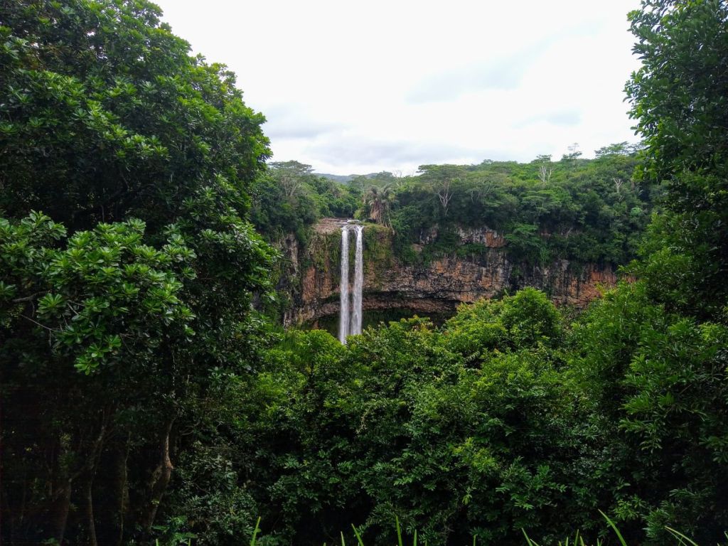
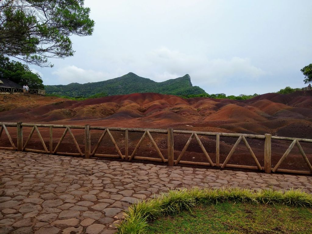
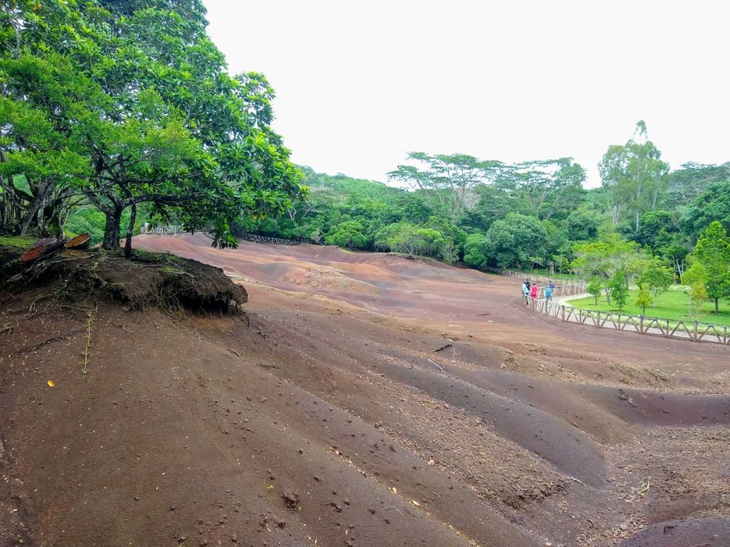
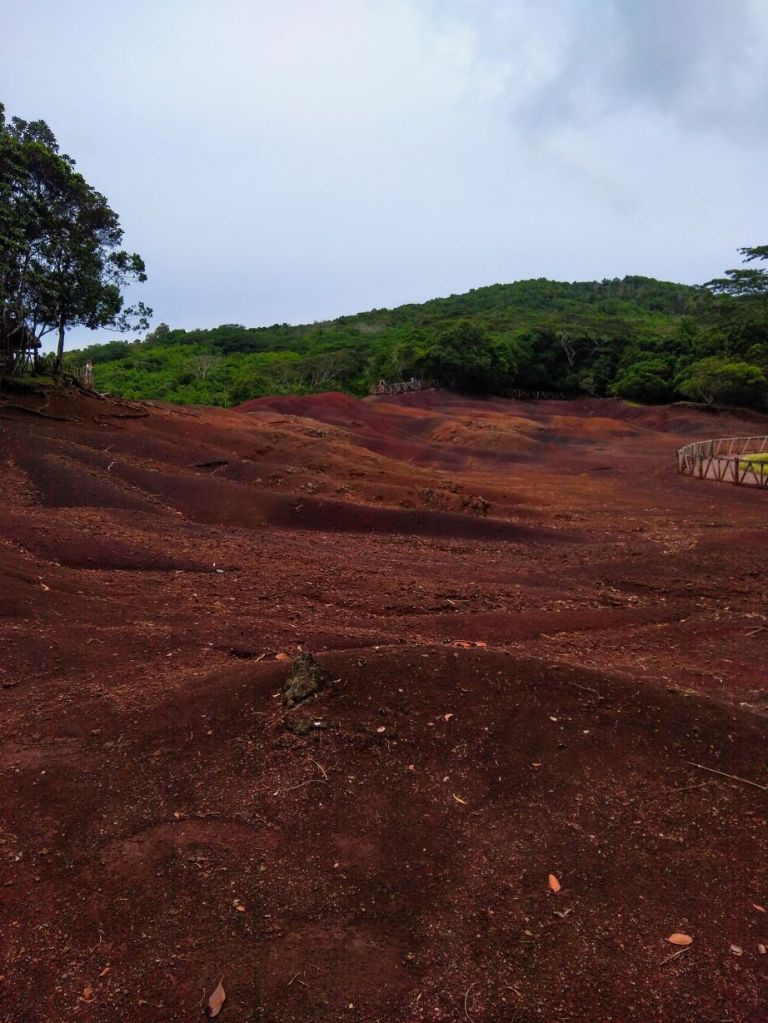
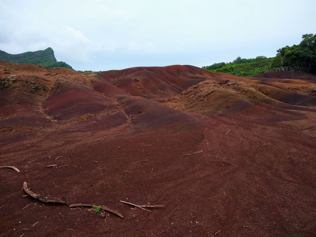
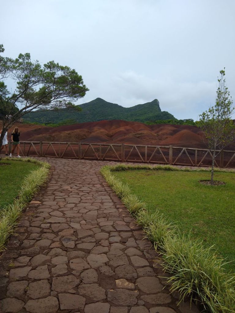
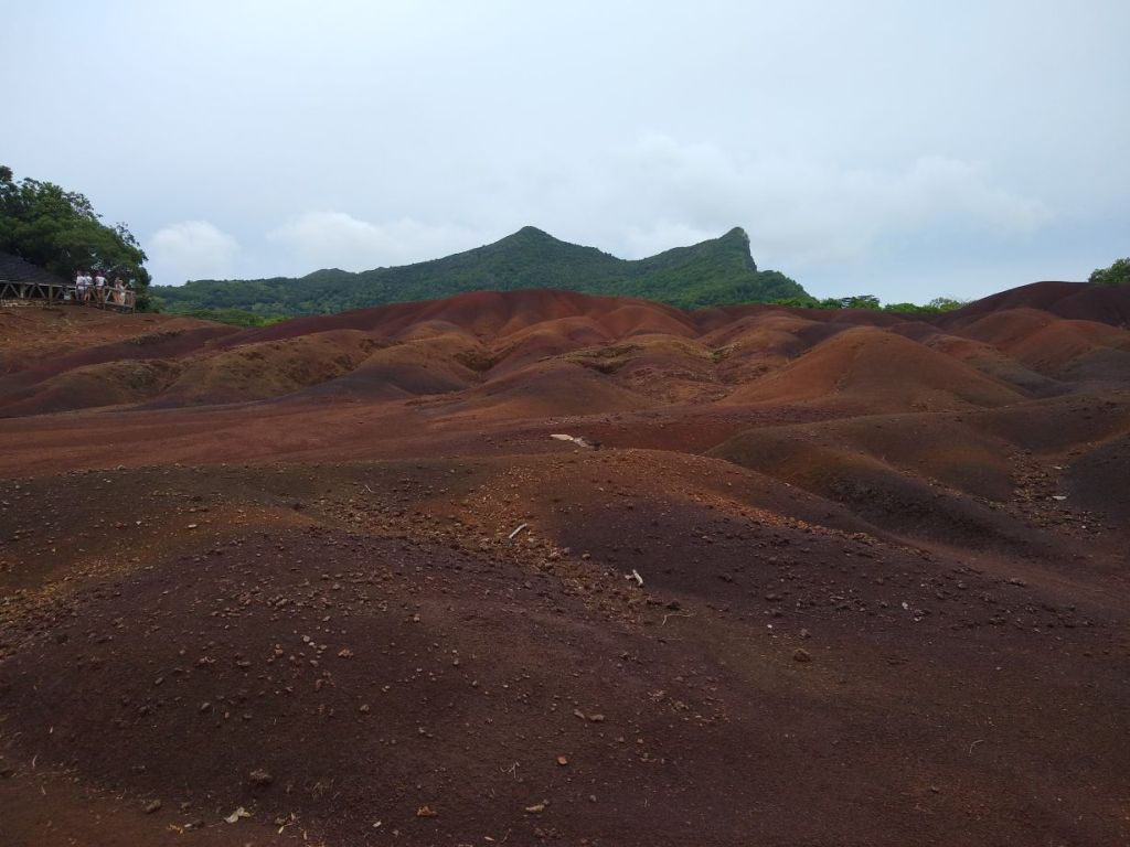
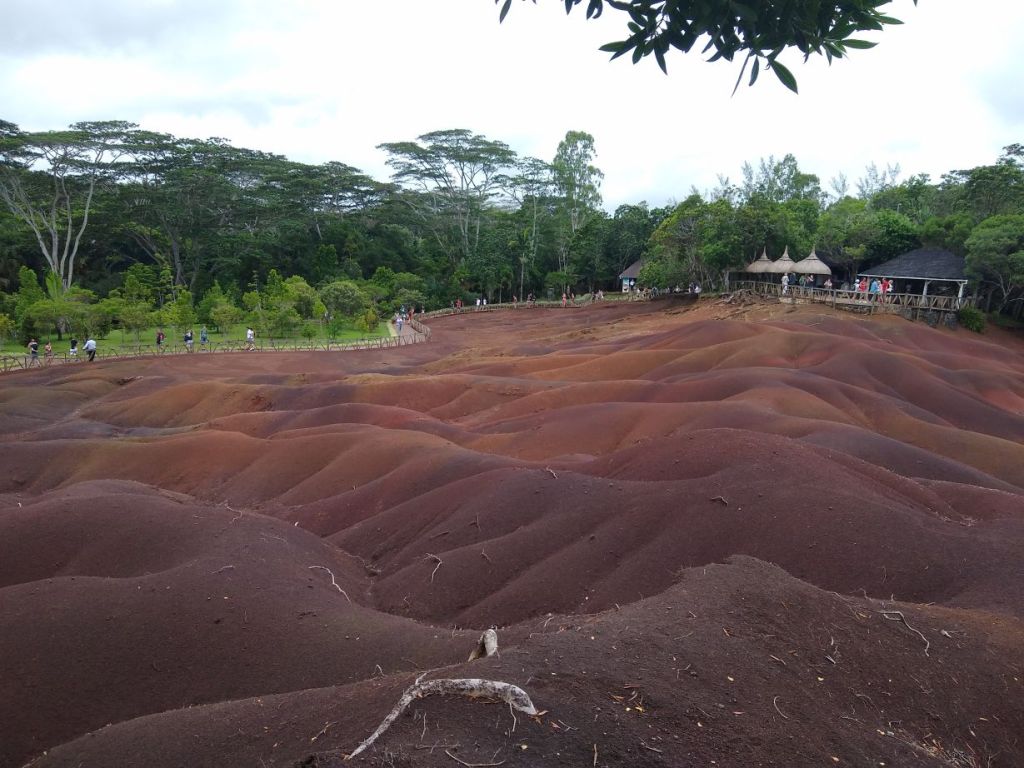
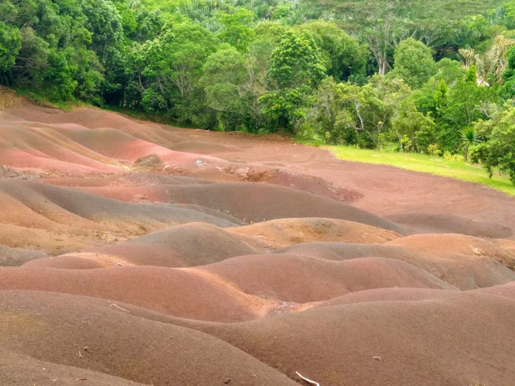
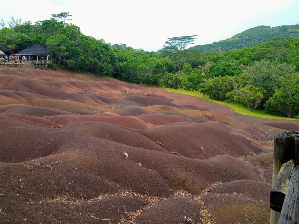
Its been a lovely drive, and we get to see so much more of the island than we would otherwise. After a few minutes further along the coast, we turn inland to head up to the Chamarel, a park with a huge waterfall and 7 colored earth (which is a series of sand dunes with different colors derived from the erosion of lava). It’s supposed to be one of major attractions on the island, but we can tell you that the drive there was every bit as major an attraction to us as was the park itself!
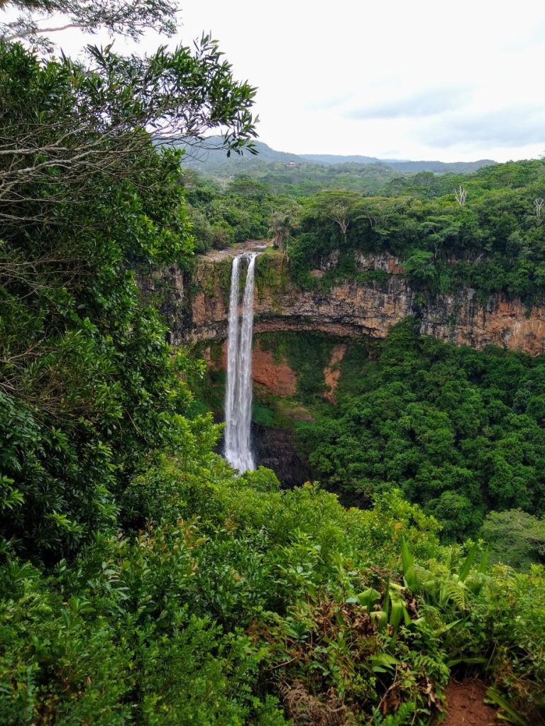
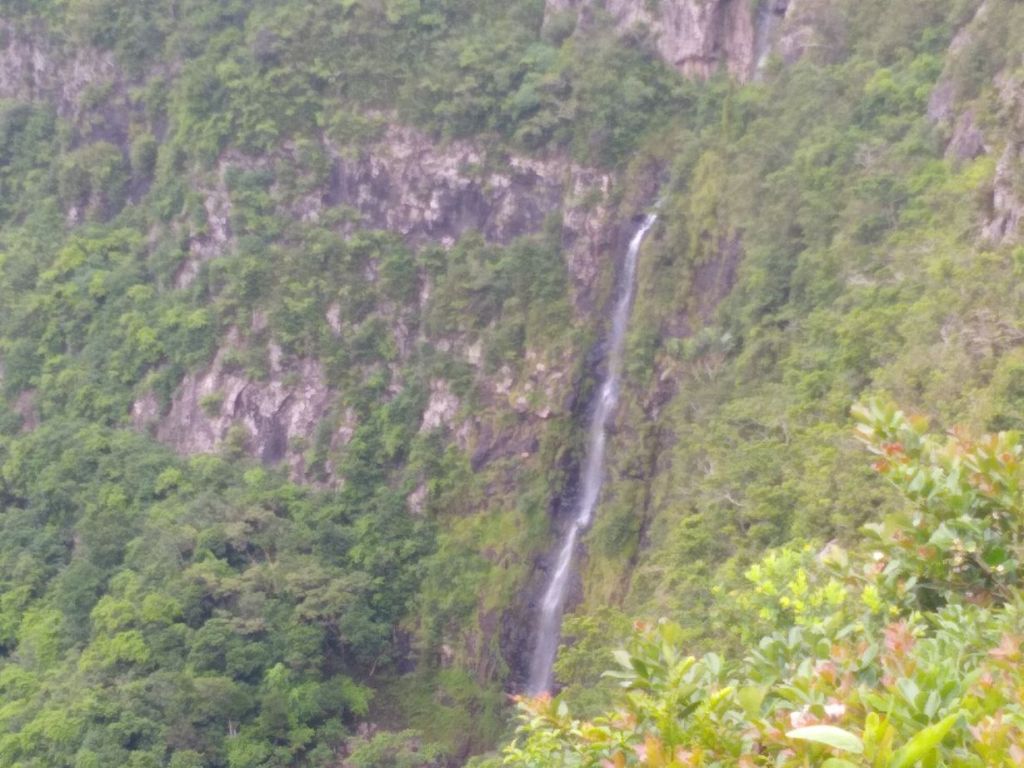
We drove through little twisty turning roads, climbing steadily up the mountain side for, oh, I don’t know, 20 minutes? 25? And NEVER saw another car. NEVER. It was fabulous, we had the road all to ourselves with the beautiful deep green foliage towering over us on each side, Seeva narrating our trip, pointing out mountain peaks and any tree, bush or flower he recognizes. Simply gorgeous. Arriving at the park, we pay our entrance fee and Seeva takes over the narration explaining the park and taking us to the waterfall for pictures. He’s so great! He always manages to just seamlessly slide right into the front of any parking area, depositing up at the very front of every entrance.
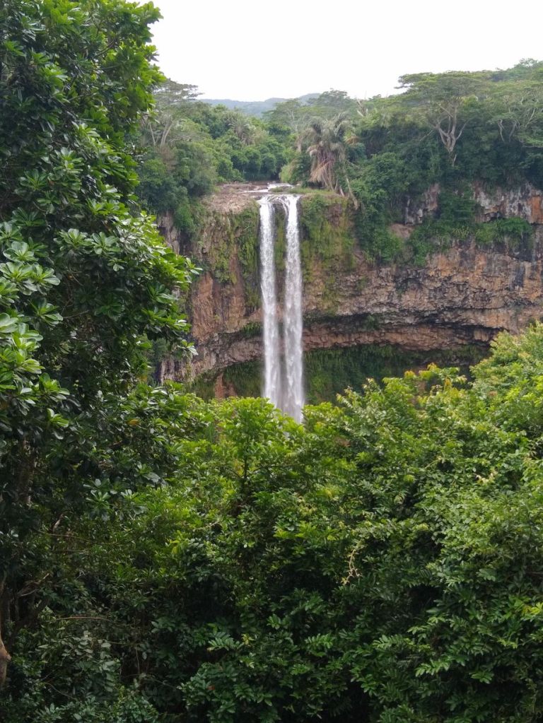
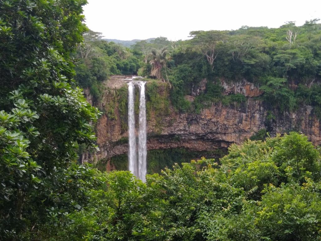
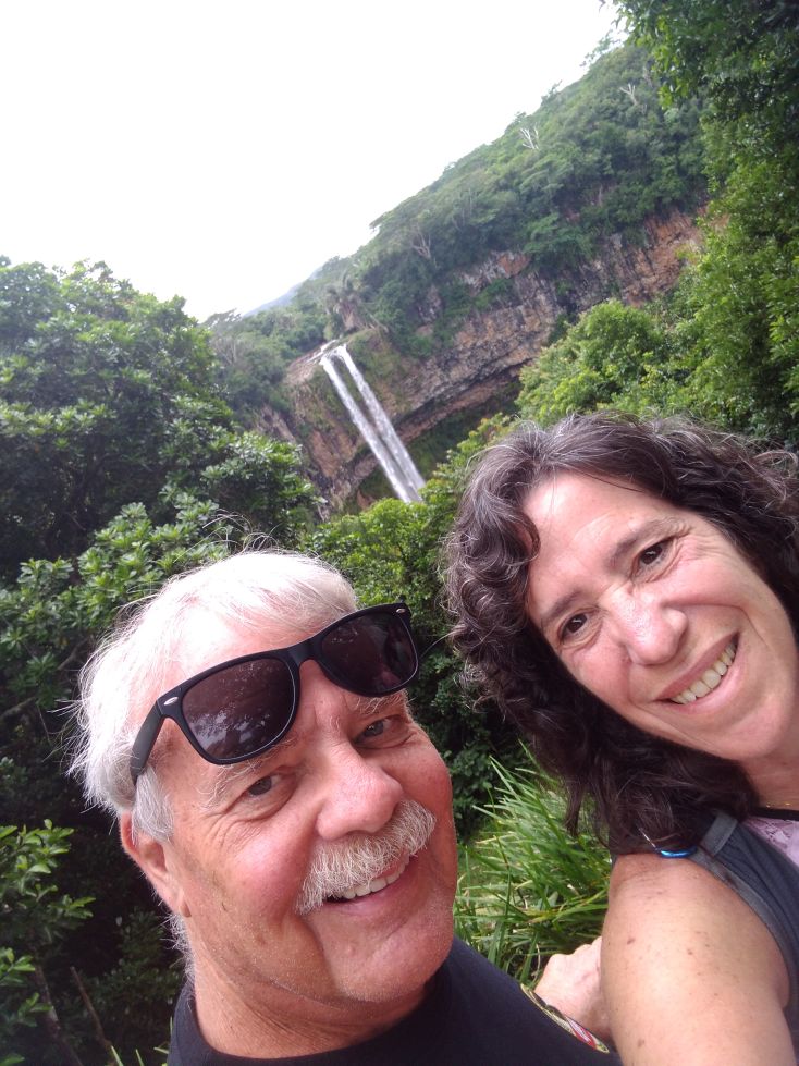
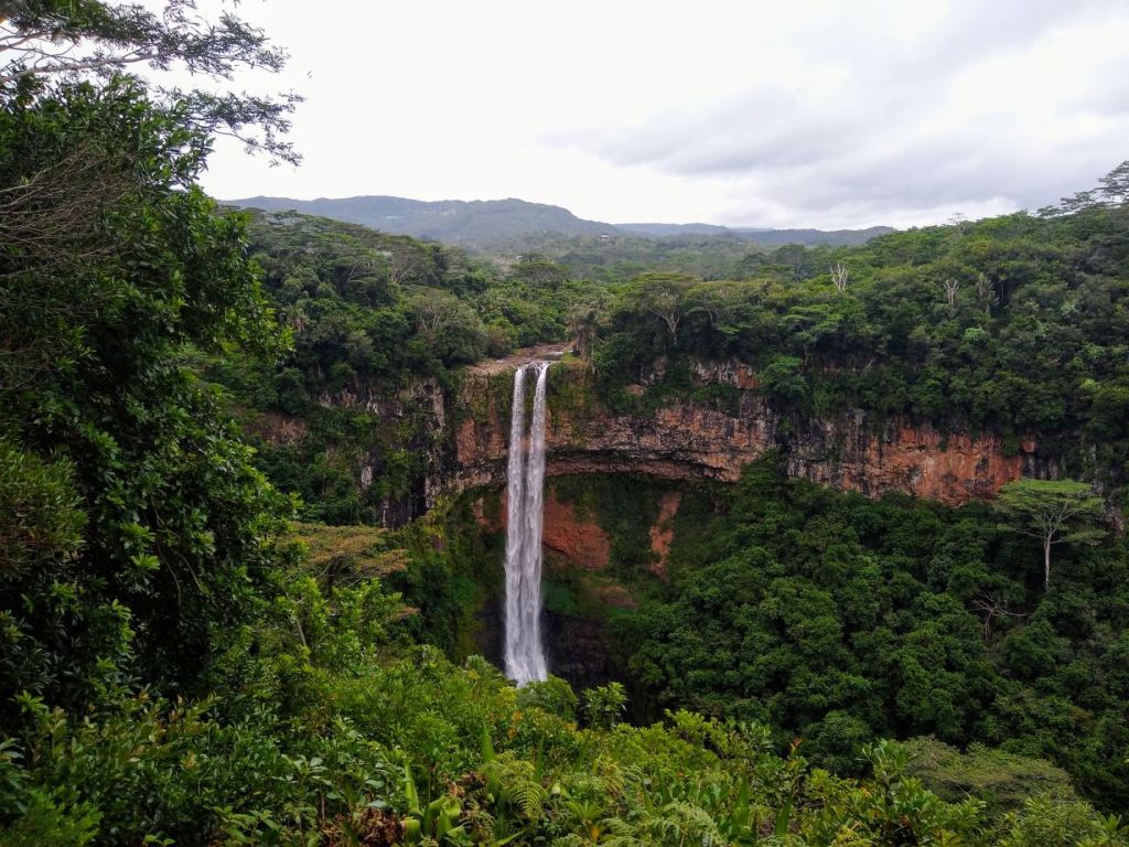
Directing us to go take pictures of the falls at the bottom then walk up to the top for the best shots, we follow Seeva’s instructions, which of course are always right! The falls are very pretty, two strong streams of water running down the multi-colored face of the cliff into a deep pool at the bottom. The view from the top is indeed the best and after a selfie (Yes, an actual selfie!), we return to Seeva just at a big group of bicyclists pull in. Great timing Seeva!
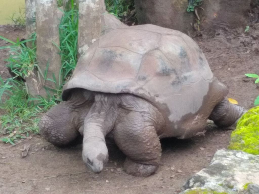
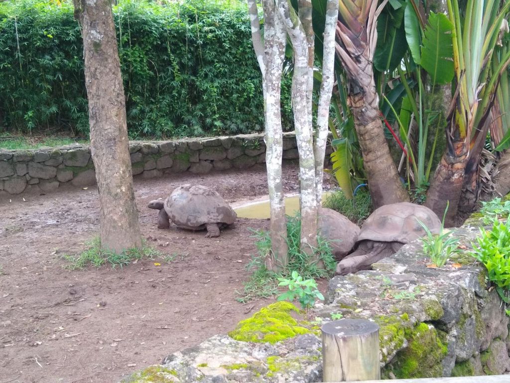
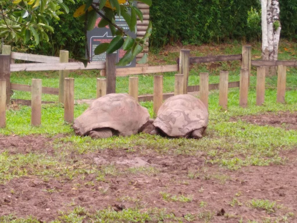
He squires us quickly to the 7 colored earth area, walks us to the ticket counter, hands in our tickets and gives us a brief explanation, then sets us free, reminding us to take pictures from all different angles because the colors change. And of course he’s right! One direction looks like all shades of brown, another has many red stripes and yet another has some greyish green. A very fascinating study on the way the earth erodes and what metals left behind do to the landscape. But to be honest, while it is cool to look at, it is a little underwhelming. To me at least, the drive here was better! Of course there are also the giant land tortoise that are in a pen across from the sand dunes. Now that was a huge happy surprise. They look just like late Lonesome George of the Galapagos. Pretty fun.
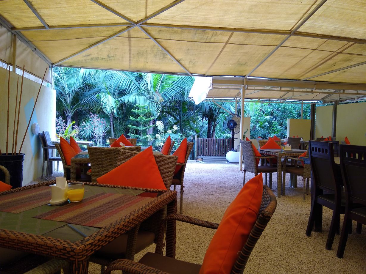
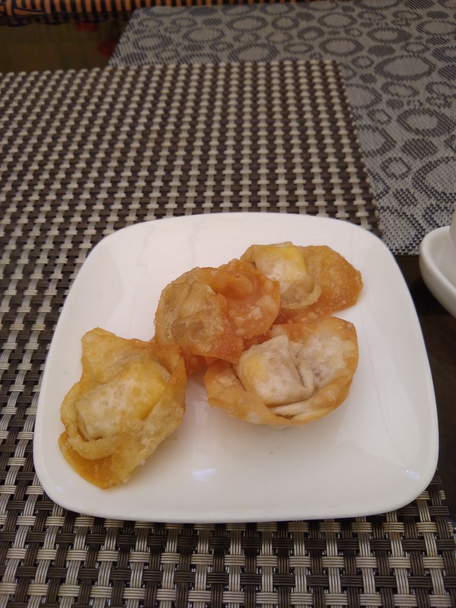
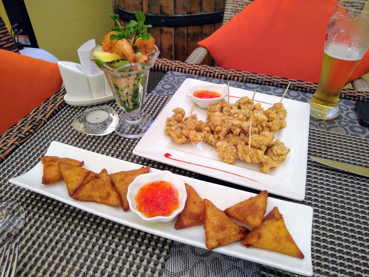
We’ve hit this visit in the sweet spot, because we’re done with our photos and beginning to leave as a ton of people start flooding the viewing area. Once again, it pays to be early – and on your own. Re-Joining Seeva, we wind our way out of the park to continue our journey, when he asks if we are hungry, which we are, so he stops at a restaurant right outside the park gates called Resto Mich. He says this is a good place to eat. Ok – he’s not been wrong yet, and he’s not wrong now. We sit outback in a cute little pebble garden area with a fan (thank god) under a large tent like umbrella structure and order apps to share: Prawns and pineapple cocktail, crispy calamari and samoussas (called Beignet des Iles). The waitress also brings a complementary plate of fried wontons with our beer and wine, which makes for a great semi-light meal for the two of us.
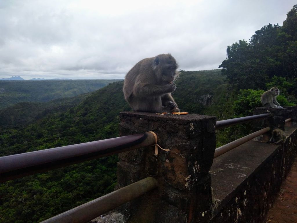
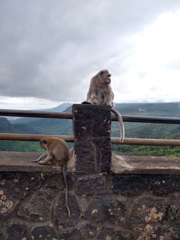
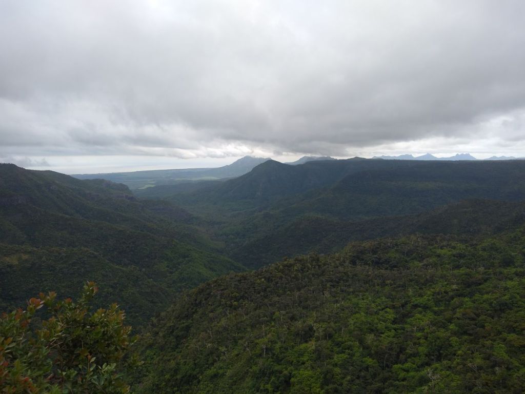
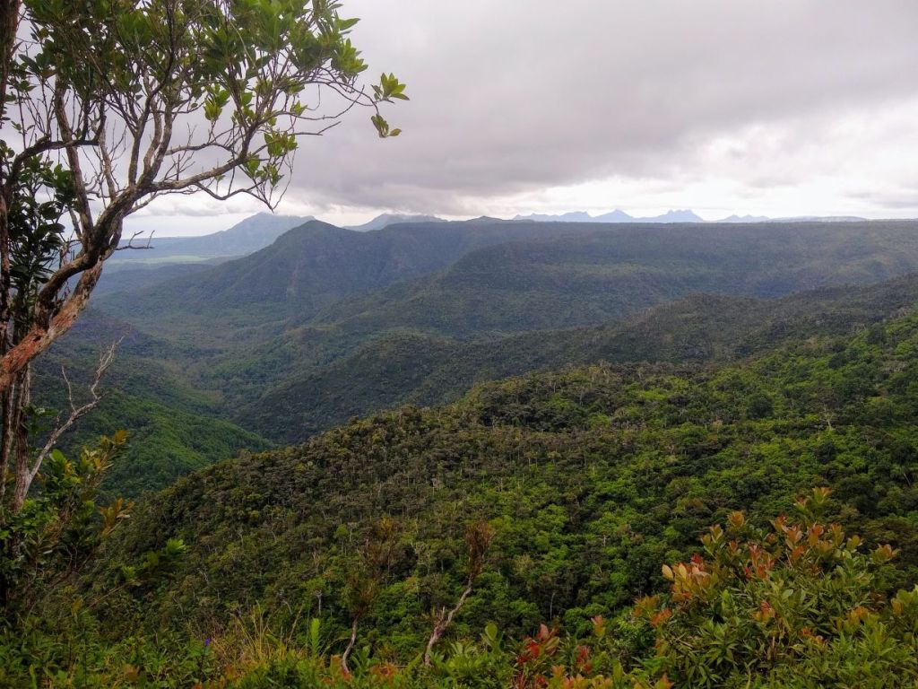
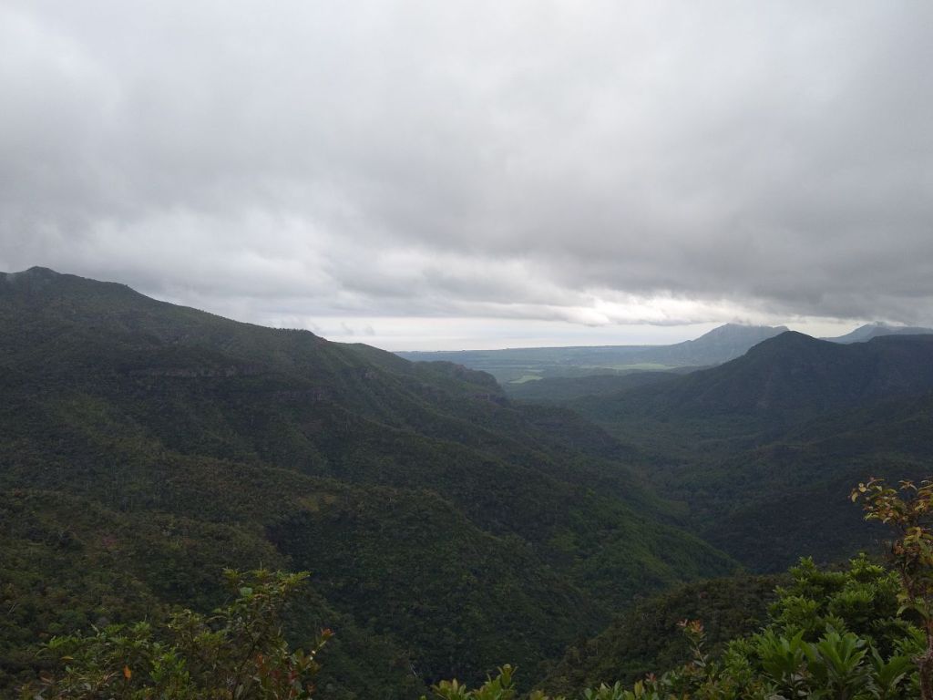
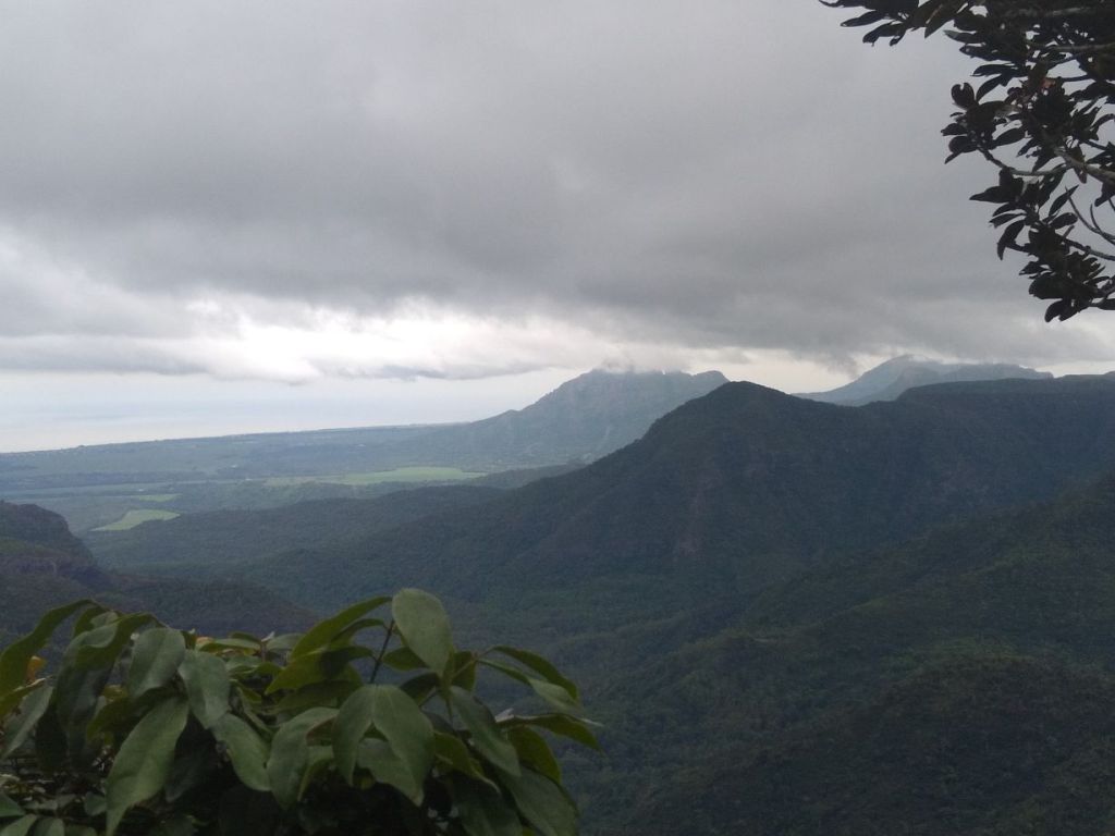
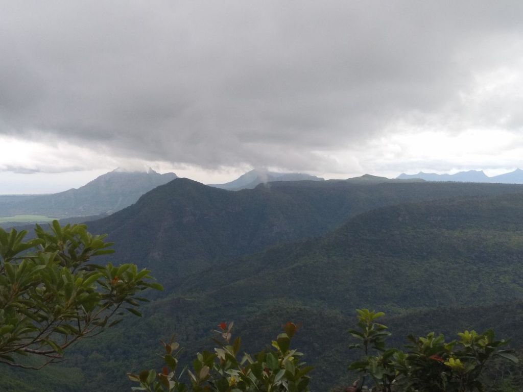
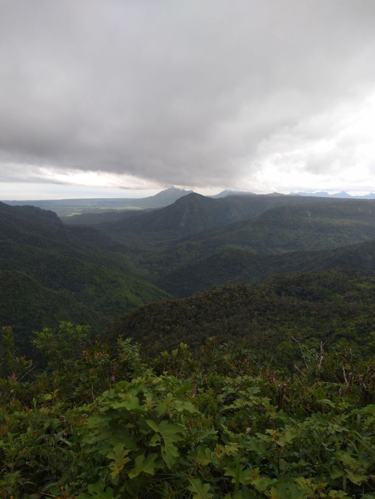
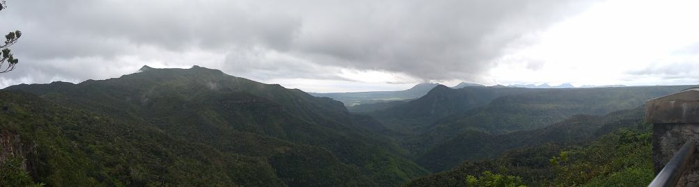
We’re refreshed and back on the road in under 45 minutes! Now we’re off to the Black River Gorges National Park, an area with hiking trails, tall mountain ridges and crests and tons of viewpoints out over the amazing scenery. We stop at the main view point for the gorges, Seeva managing to find a parking space right at the boardwalk entrance making it easy for us to get right out on the boardwalk to the gorge. There are tons of souvenir vendors here, but we aren’t interested, we want to see the gorge (and avoid the people clogging the walk by the vendors). Our bonus for hurrying to the viewpoint are the monkeys who are sitting on the fence posts munching on fruit and playing around with each other. They are great posers – and we get some really fun photos of their antics.
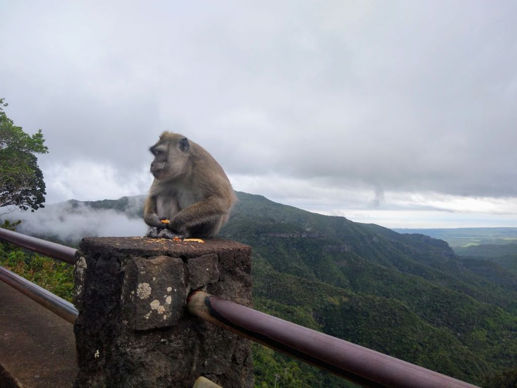
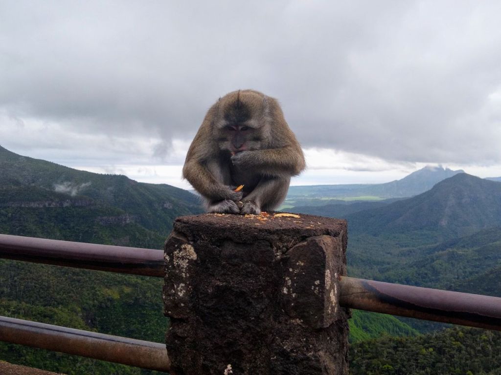

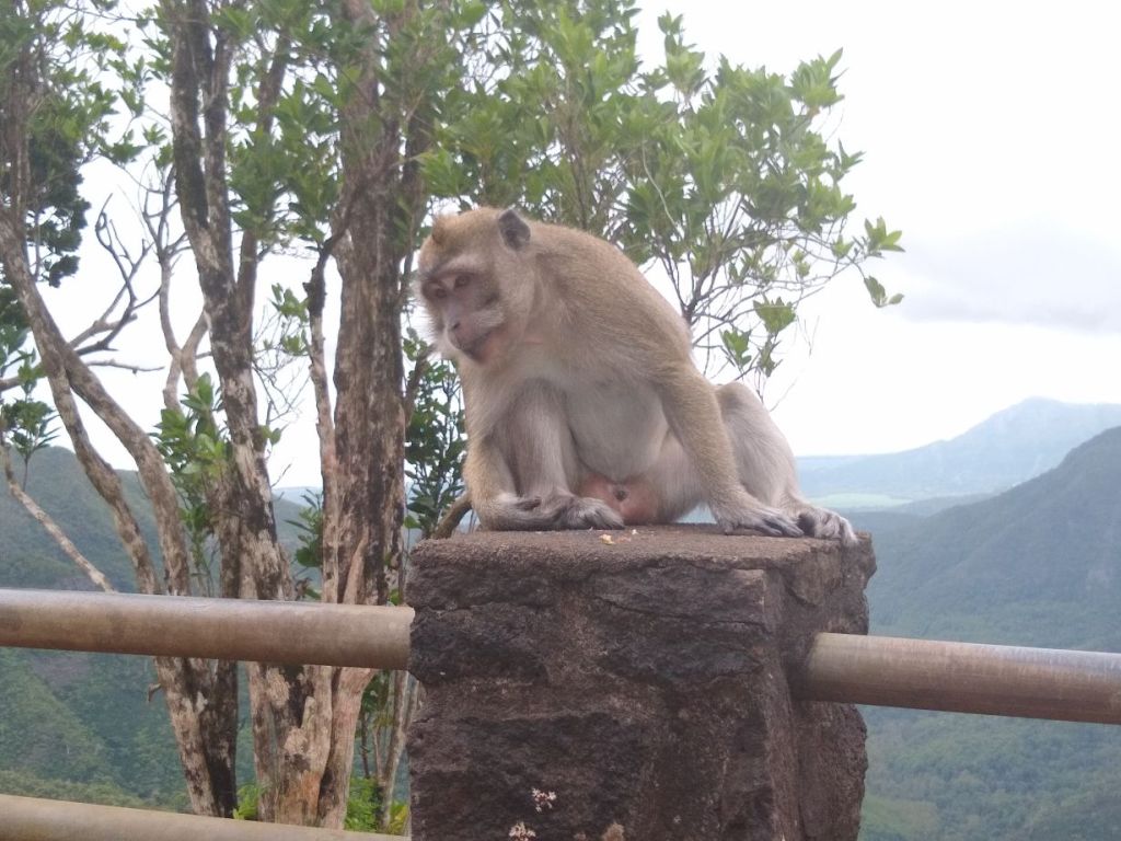
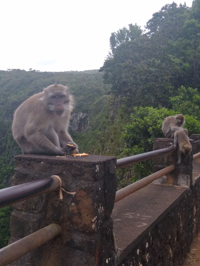
But the gorge is the real attraction, and it is stunning. Even though it is a cloudy day, you can still see forever across the range of mountains and ridges covered in varying shades of green foliage. It is ever so pretty – I’m running out of words to describe it all!
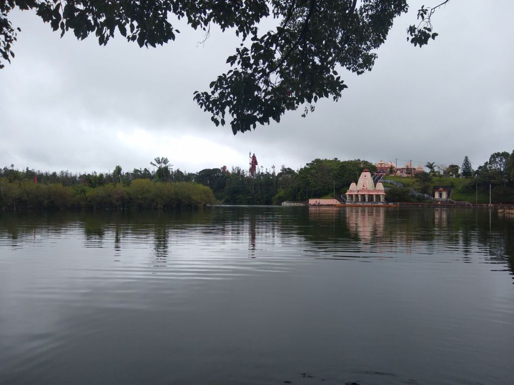
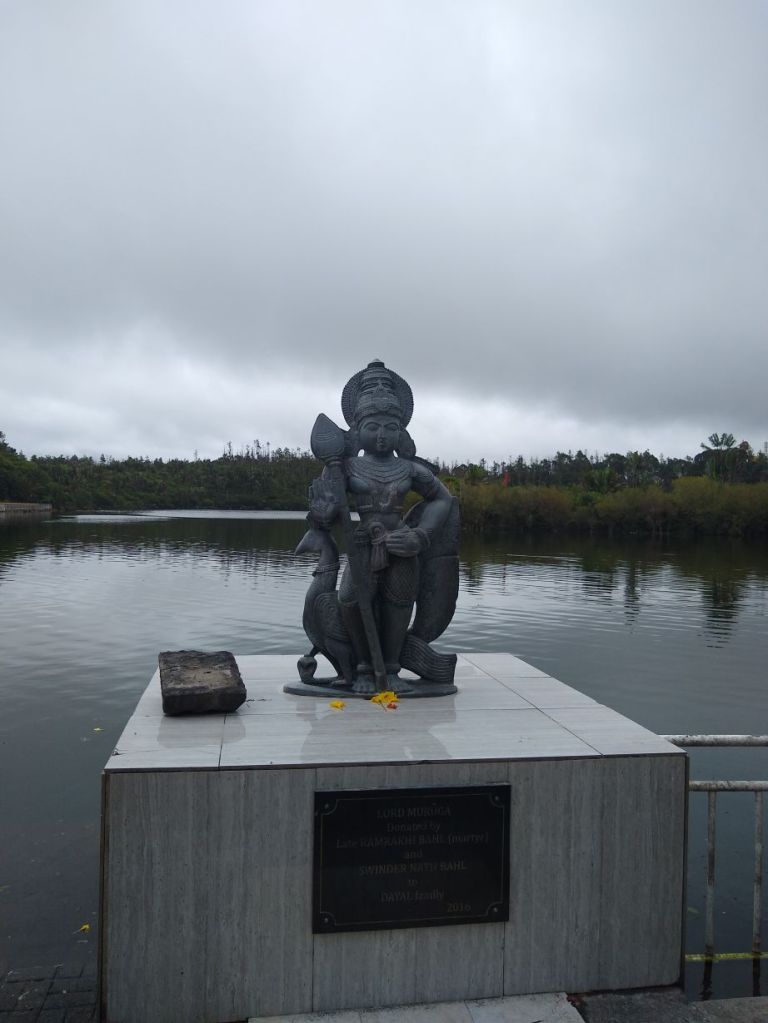
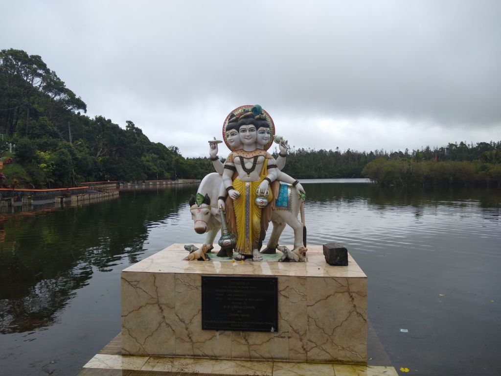
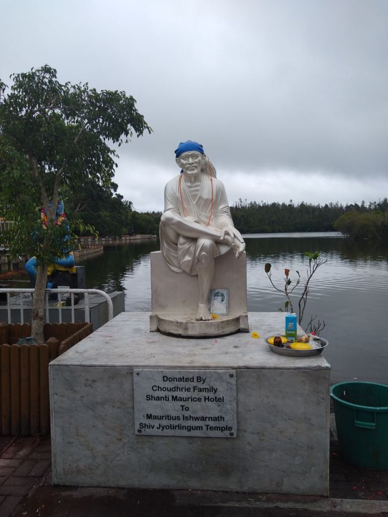
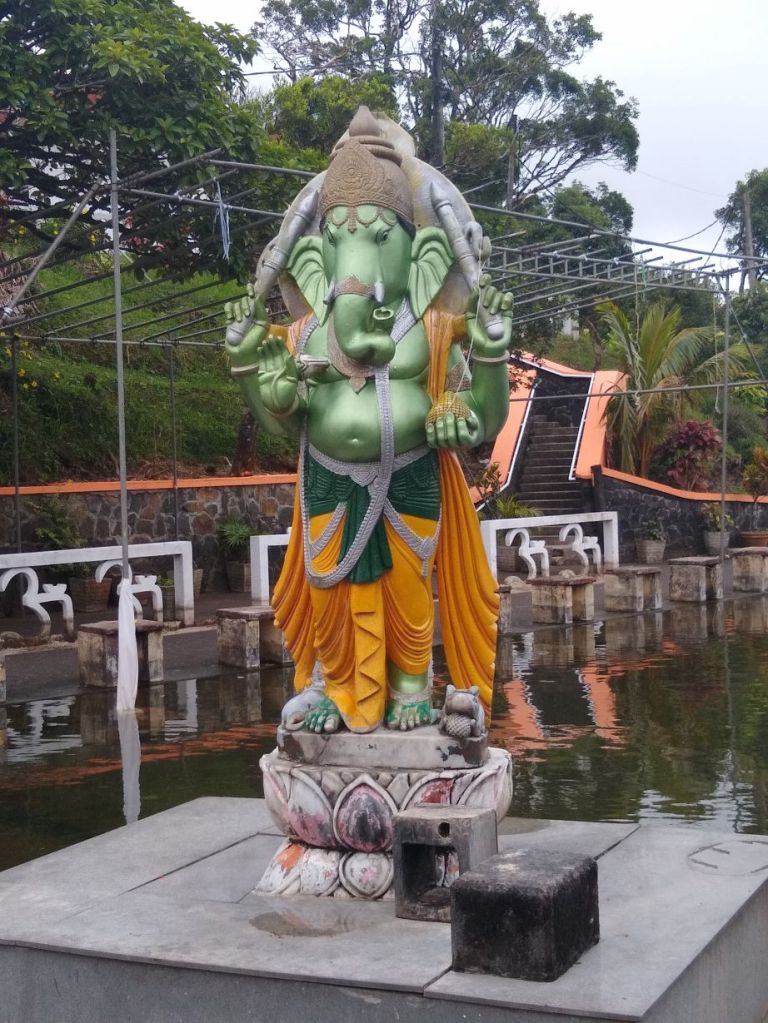
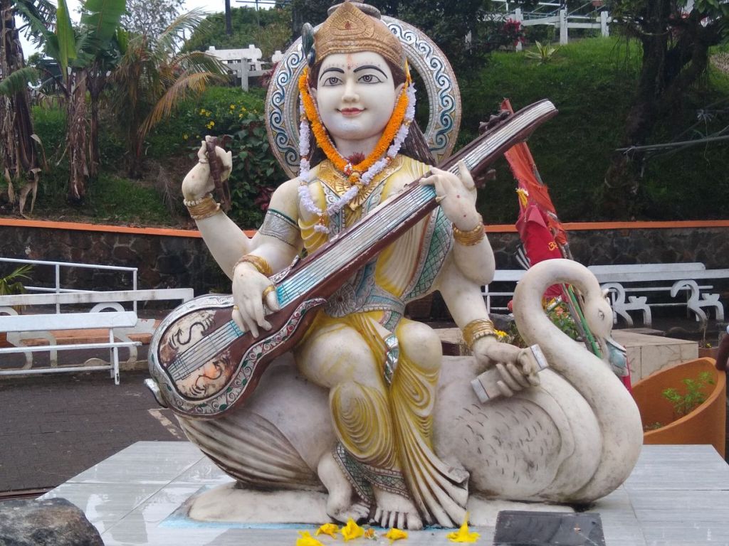
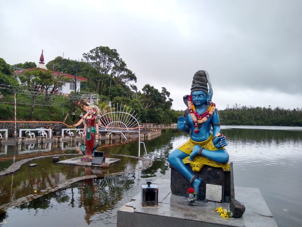
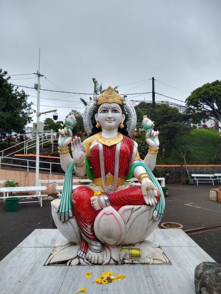
Once again, our timing is impeccable. We are just as all the Azamara buses pull in. As a matter of fact, there are so many of them that we are almost blocked from getting out, but Seeva knows everyone, and he manages to get the guys directing parking and buses to move the bus so we can leave. Then we head to Ganga Talao, a crater lake with a temple that is the sacred pilgrimage site of the Hindus of Plaine Champagne. The complex consists of these huge statues of Shiva and Shiva’s wife (the warrior incarnation of the wife, that is), 33 meters tall, they virtually “guard” the entrance to the temple on the lake below.
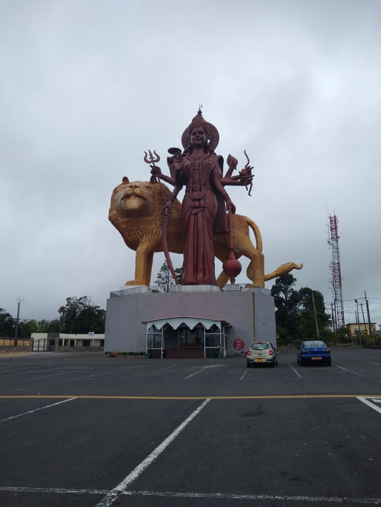
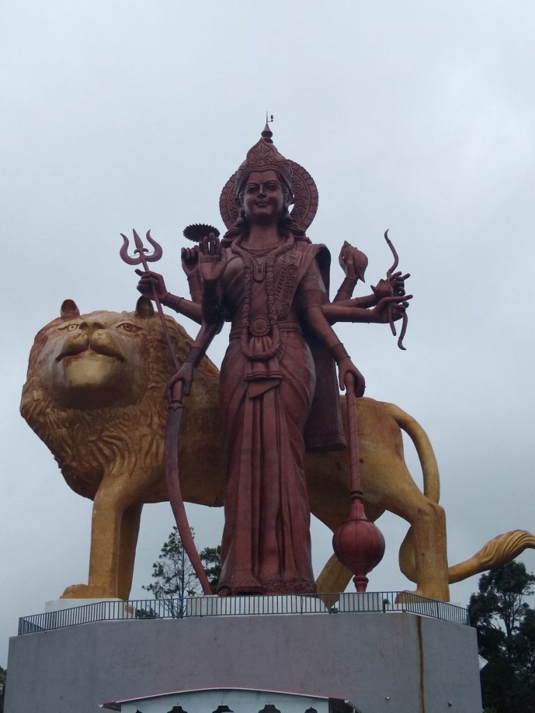
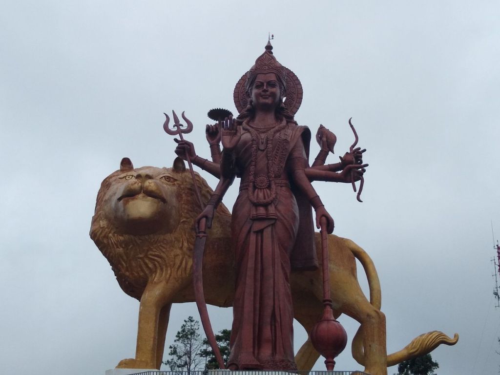
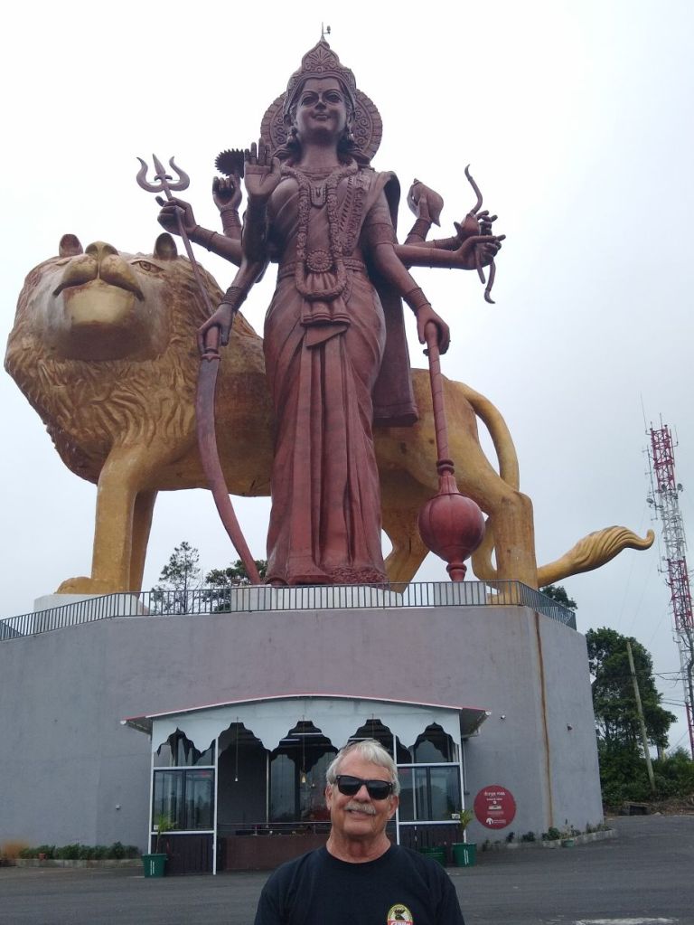
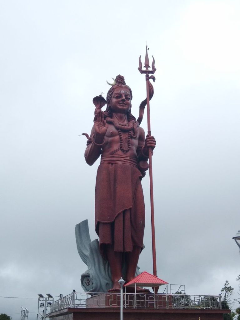
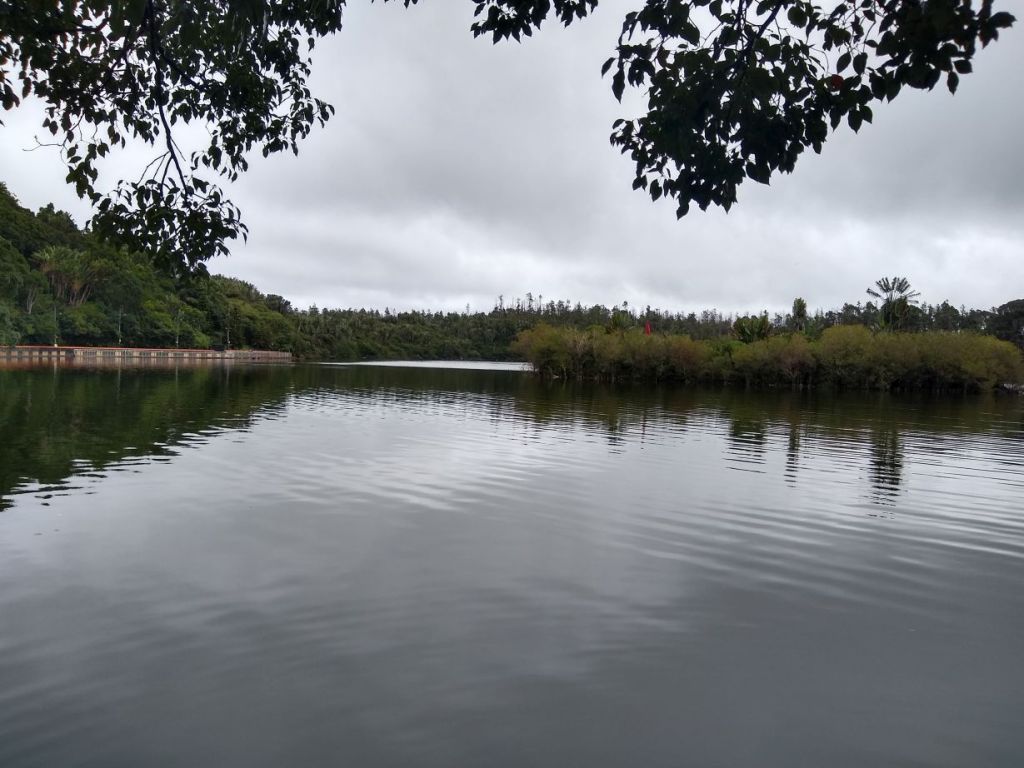
As we walk up to each of these huge murtis, Seeva tells us that 700,000 pilgrims visit this site during the holidays – oh my god – 700,000 people? It’s a big area, but, not that big, I’m claustrophobic just thinking about it. Many actually walk here from other areas of the island, making it a true pilgrimage. After marveling at the statues, we head down the road and into the crater to view the lake, which is absolutely gorgeous. Clear, crisp water reflecting the muted sunlight bouncing off the clouds with the temple on a distance shore. And more murtis of the important gods, many on pedestals in the water. We visit the temple on this side of the lake, then slowly walk our way back up to the car, leaving the spiritual quietness of the water behind.
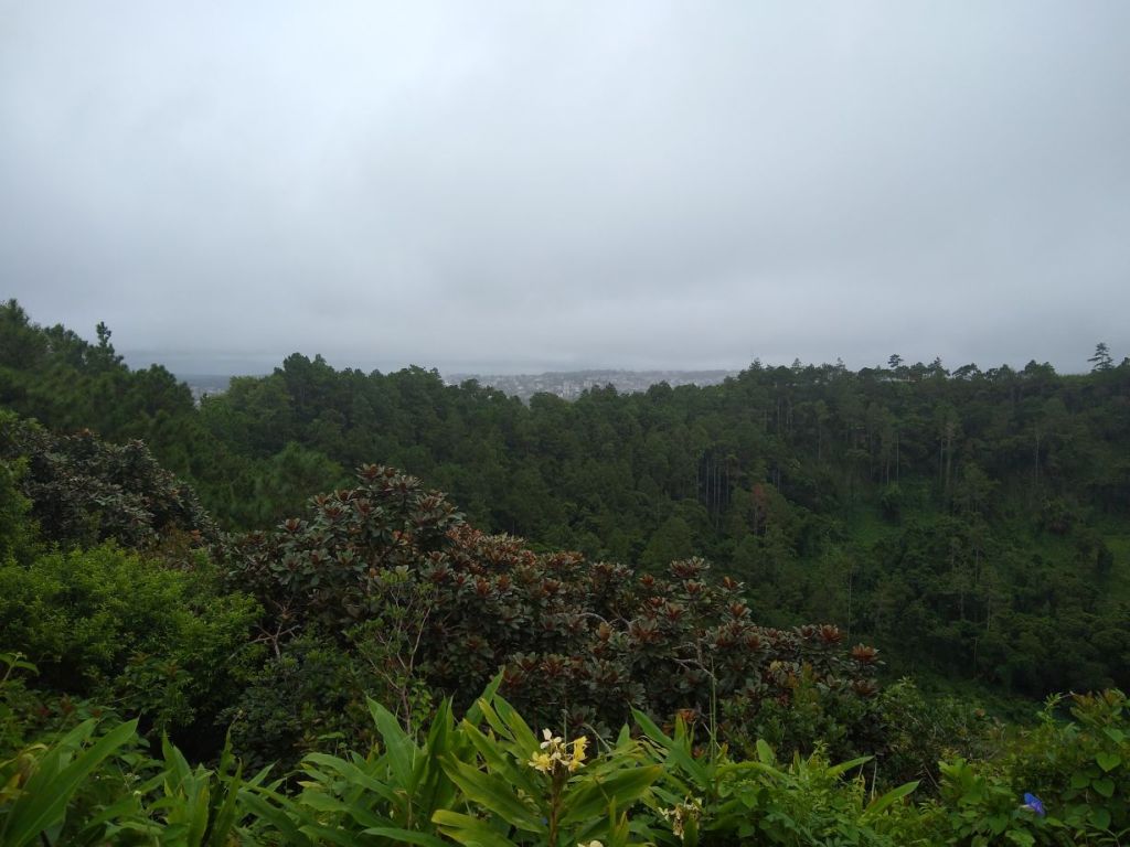
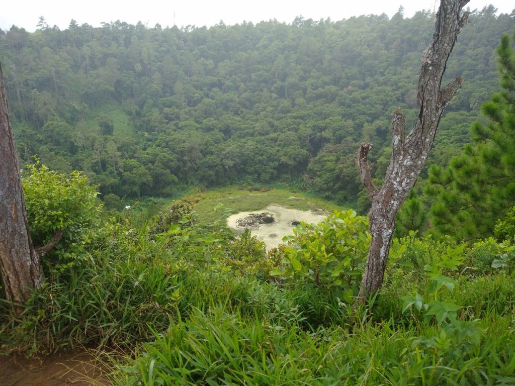
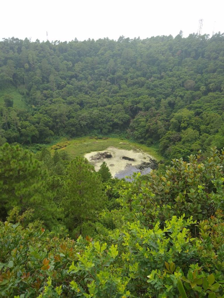
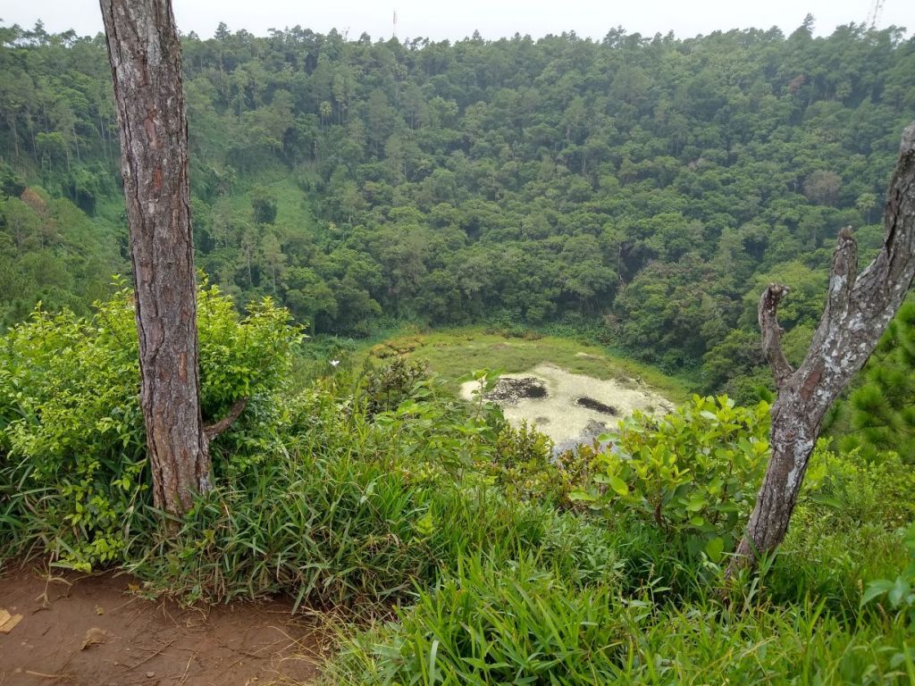
Our last stop is the crater of the inactive volcano, Trou-Aux-Cerfs, which is a deep pit filled with green trees and an algae covered pond at the base. It’s virtually right in the middle of Curepipe – so much so that on the drive up we went through all these city streets and little alleys and I had no idea where we were going! But Seeva knows this island like the back of his hand (and it doesn’t hurt that his wife is from Curepipe!). Suddenly, we are out of the neighborhoods and way high up in the mountains with a little parking lot overlooking the volcano crater. On a clear day Seeva says we could see Port Louis and the water, but today the cloud cover impedes the long views. Doesn’t make it any less beautiful though – and it makes for a great last stop on our round the island tour.
An hour later, we are back in the port saying a fond farewell to Seeva. He gives us his card and tells us to keep in touch, and he will send me some Mauritius Chayote recipes (because we had talked about the invasive vegetable plant on our drive back into town). What a great find, the Mauritius Taxi company, and particularly Seeva. We had a great two days.
Back aboard with plenty of time to spare, we grab a drink and go sit on the balcony when we notice the fuel barge is back. Hmmm. That’s a little disturbing. And when the captain says we’ve sailed, he says we are sailing to our next port. Period. Not our next port, Colombo. He always says the port name…..yeah, something is afoot for certain! We shall see what tomorrow brings!
